Elected Officials
Courts
Departments
Initiatives
Open Government
About
Login / Register
Home
/
Property & Tax Records
/
Property Records
/
Property & Tax Search
/
Parcel Profile
/
Print View
Search for Another Parcel
Parcel Profile
Historical Card
Sketches
Photos
Tax Map
Taxes
Print View
Print This Page
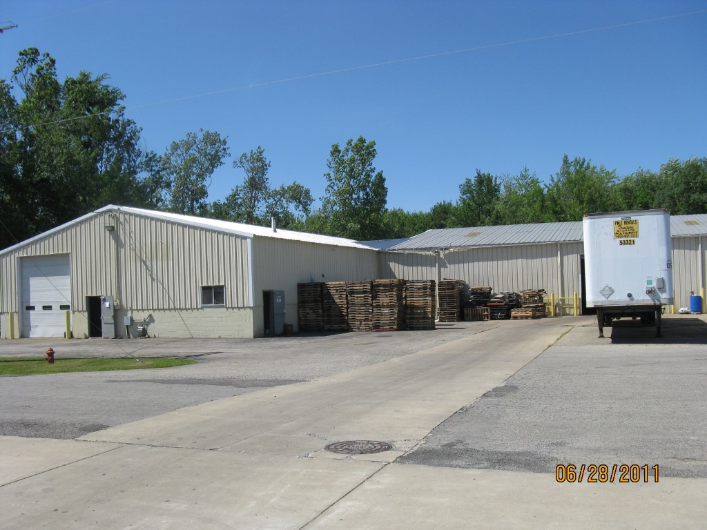
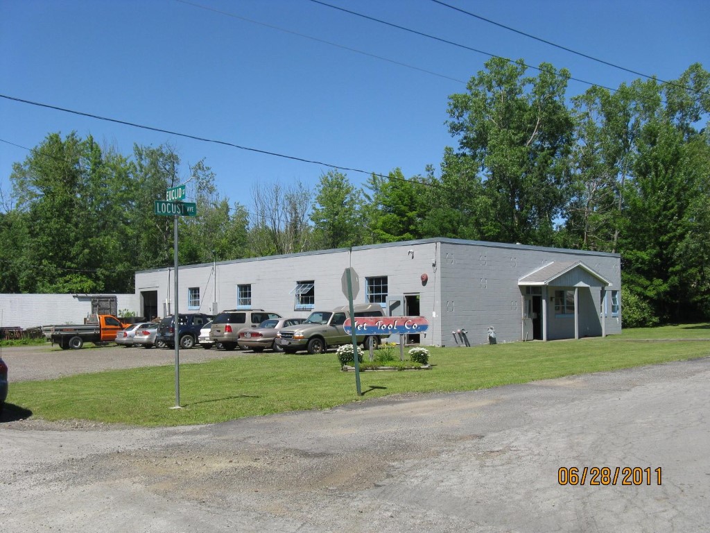
Address: 20 LOCUST ST
Parcel: 01002004000300
Parcel Profile
Address
20 | LOCUST | ST
Street Status
PAVED
School District
NORTHWESTERN SCHOOL
Acreage
0.9180
Classification
C
Land Use Code
WAREHOUSES
Legal Description
20 LOCUST ST 200 X 200 | LOTS 325-328, PT 333, 334-336 ROGERS BROS ADDN
Square Feet
5328
Topo
LEVEL
Utility
ALL PUBLIC
Zoning
Please contact your municipal zoning officer
Deed Book
2016
Deed Page
020116
2026 Tax Values
Land Value / Taxable
40,000 / 40,000.00
Building Value / Taxable
63,800 / 63,800.00
Total Value / Taxable
103,800 / 103,800.00
Clean & Green
Inactive
Homestead Status
Inactive
Farmstead Status
Inactive
Lerta Amount
0
Lerta Expiration Year
0
Commercial Data
Card 1
WAREHOUSE
Business Living Area - 5328
Year Built - 1960
Improvement Name - JET TOOL INC
Value - 63780
Other Buildings & Yards
No OBY Data Found
Sales History
Sale Date
Type
Price
Book / Page
Other Info
9/16/2016
LAND & BUILDING
0
2016 / 020116
DEED
11/20/2003
LAND & BUILDING
100000
1088 / 0013
WARRANTY/SURVIVORSHIP DEED
10/22/1973
LAND & BUILDING
0
1108 / 0054
10/22/1973
40000
1108 / 0049
3/8/1967
0
0956 / 0475
2/25/1911
0
0182 / 0820
Parcel Sketches
Commercial Card 1
A
MAIN
4896 square feet
B
MAIN
432 square feet
Parcel Images
Please note:
this tab is for informational purposes only and may not show all delinquencies, see the Taxes tab for more accurate delinquent taxes due.