Elected Officials
Courts
Departments
Initiatives
Open Government
About
Login / Register
Home
/
Property & Tax Records
/
Property Records
/
Property & Tax Search
/
Parcel Profile
/
Print View
Search for Another Parcel
Parcel Profile
Historical Card
Sketches
Photos
Tax Map
Taxes
Print View
Print This Page
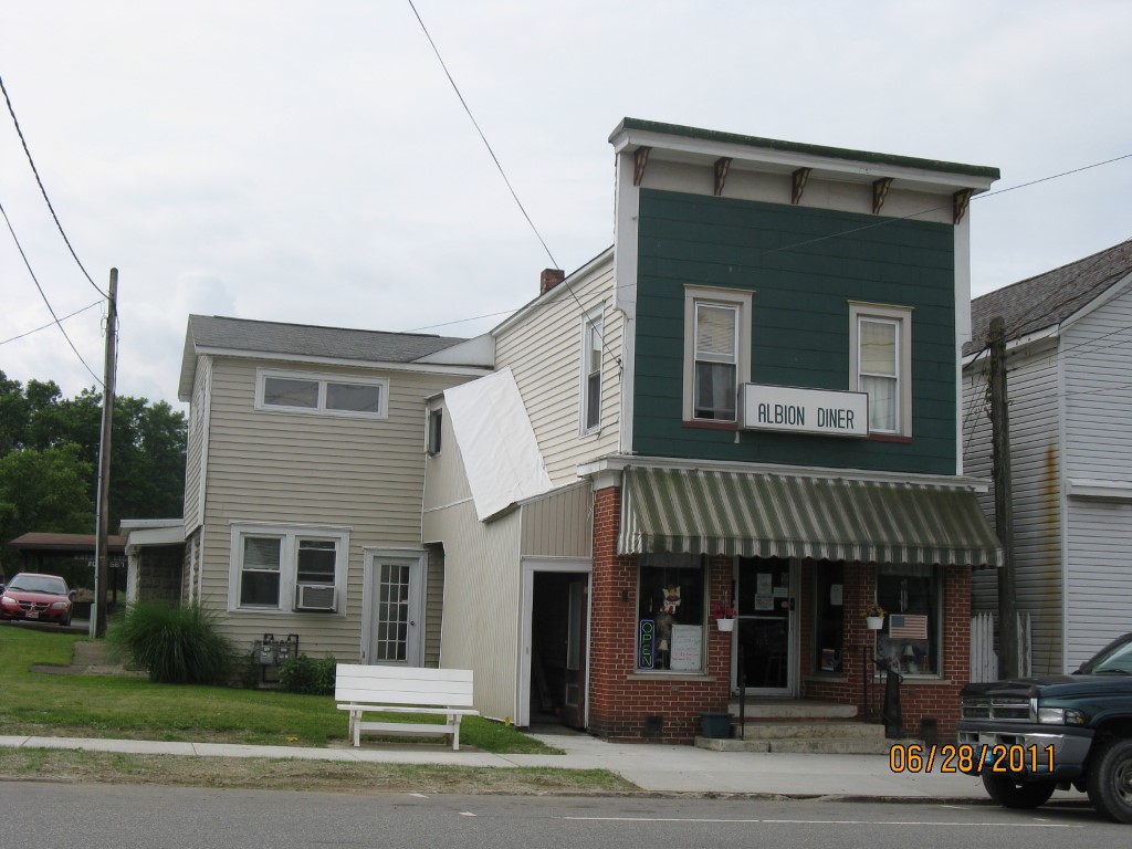
Address: 79 E STATE ST
Parcel: 01004044001100
Parcel Profile
Address
79 | E | STATE | ST
Street Status
PAVED | SIDEWALK
School District
NORTHWESTERN SCHOOL
Acreage
0.0886
Classification
C
Land Use Code
RESTAURANTS, STORES (RETAIL)
Legal Description
79 E STATE ST 38.6X100
Square Feet
3183
Topo
LEVEL
Utility
ALL PUBLIC
Zoning
Please contact your municipal zoning officer
Deed Book
2021
Deed Page
007089
2026 Tax Values
Land Value / Taxable
7,700 / 7,700.00
Building Value / Taxable
44,900 / 44,900.00
Total Value / Taxable
52,600 / 52,600.00
Clean & Green
Inactive
Homestead Status
Inactive
Farmstead Status
Inactive
Lerta Amount
0
Lerta Expiration Year
0
Commercial Data
Card 1
MIXED RES/COMM
Business Living Area - 3183
Year Built - 1930
Improvement Name - HENRETTY'S DINOR
Value - 43980
Other Buildings & Yards
No OBY Data Found
Sales History
Sale Date
Type
Price
Book / Page
Other Info
3/25/2021
LAND & BUILDING
79900
2021 / 007089
WARRANTY/SURVIVORSHIP DEED
10/4/1995
LAND & BUILDING
32500
0406 / 1294
10/3/1995
LAND & BUILDING
32500
406 / 1294
Parcel Sketches
Commercial Card 1
A
MAIN
2181 square feet
B
MAIN
1002 square feet
Parcel Images
Please note:
this tab is for informational purposes only and may not show all delinquencies, see the Taxes tab for more accurate delinquent taxes due.