Elected Officials
Courts
Departments
Initiatives
Open Government
About
Login / Register
Home
/
Property & Tax Records
/
Property Records
/
Property & Tax Search
/
Parcel Profile
/
Print View
Search for Another Parcel
Parcel Profile
Historical Card
Sketches
Photos
Tax Map
Taxes
Print View
Print This Page
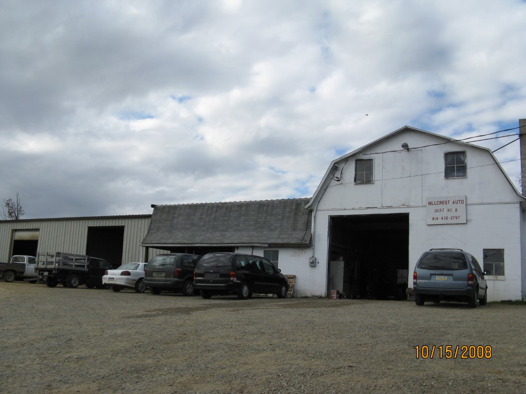
Address: 15052 ROUTE 8
Parcel: 02009024001101
Parcel Profile
Address
15052 | ROUTE 8
Street Status
PAVED
School District
WATTSBURG SCHOOL
Acreage
13.5900
Classification
C
Land Use Code
GARAGES/SHOP/CAR DEALERS
Legal Description
15052 ROUTE 8 13.593 AC
Square Feet
8285
Topo
LEVEL
Utility
WELL | SEPTIC
Zoning
Please contact your municipal zoning officer
Deed Book
2012
Deed Page
012197
2026 Tax Values
Land Value / Taxable
33,900 / 33,900.00
Building Value / Taxable
65,800 / 65,800.00
Total Value / Taxable
99,700 / 99,700.00
Clean & Green
Inactive
Homestead Status
Inactive
Farmstead Status
Inactive
Lerta Amount
0
Lerta Expiration Year
0
Commercial Data
Card 1
AUTO SERVICE GARAGE
Business Living Area - 8285
Year Built - 1963
Improvement Name - HILLCREST AUTO
Value - 65760
Other Buildings & Yards
No OBY Data Found
Sales History
Sale Date
Type
Price
Book / Page
Other Info
5/14/2012
LAND & BUILDING
0
2012 / 012197
QUIT CLAIM DEED
12/2/1998
LAND & BUILDING
85000
603 / 1187
9/4/1975
25000
1170 / 0186
Parcel Sketches
Commercial Card 1
A
MAIN
7930 square feet
B
MAIN
355 square feet
Parcel Images
Please note:
this tab is for informational purposes only and may not show all delinquencies, see the Taxes tab for more accurate delinquent taxes due.