Elected Officials
Courts
Departments
Initiatives
Open Government
About
Login / Register
Home
/
Property & Tax Records
/
Property Records
/
Property & Tax Search
/
Parcel Profile
/
Print View
Search for Another Parcel
Parcel Profile
Historical Card
Sketches
Photos
Tax Map
Taxes
Print View
Print This Page
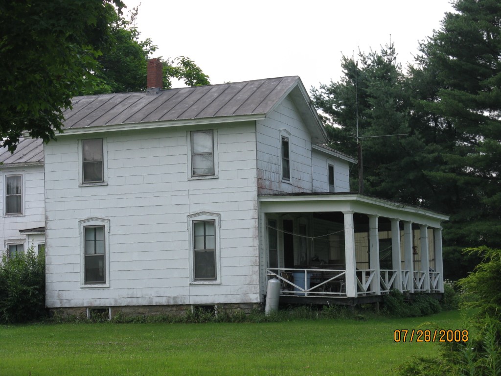
Address: 19022 ROUTE 89 TR 47 7.0558 AC
Parcel: 03006017000400
Parcel Profile
Address
19022 | ROUTE 89 TR 47 7.0558 AC
Street Status
PAVED
School District
CORRY AREA SCHOOL
Acreage
7.0558
Classification
R
Land Use Code
SINGLE FAMILY
Legal Description
19022 ROUTE 89 LOT 3 7.0558 AC
Square Feet
2512
Topo
ABOVE STREET
Utility
GAS | WELL | SEPTIC
Zoning
Please contact your municipal zoning officer
Deed Book
0681
Deed Page
0591
2026 Tax Values
Land Value / Taxable
13,200 / 13,200.00
Building Value / Taxable
63,710 / 63,710.00
Total Value / Taxable
76,910 / 76,910.00
Clean & Green
Inactive
Homestead Status
Active
Farmstead Status
Inactive
Lerta Amount
0
Lerta Expiration Year
0
Residential Data
Card 1
Style
OLD STYLE
Basement
PART
Year Built
1870
Exterior Wall
COMPOSITION
Total Living Area
2512
Full Baths
2
Half Baths
0
Fuel Type
OIL
Heating
CENTRAL
Heating System
FORCED AIR
Stories
2.0
Total Bedrooms
4
Total Family Rooms
0
Total Rooms
10
Fireplaces
0
Other Buildings & Yards
Description
Built
Width
Length
Area
FRAME UTILITY SHED
1950
16
26
416
CARPORT
2022
12
14
168
Sales History
Sale Date
Type
Price
Book / Page
Other Info
8/16/1954
0
0681 / 0591
Parcel Sketches
Residential Card 1
A
MAIN
1256 square feet
B
WDDCK WOOD DECKS
248 square feet
C
EFP ENCL FRAME PORCH
128 square feet
D
EFP ENCL FRAME PORCH
30 square feet
E
OFP OPEN FRAME PORCH
368 square feet
F
EFP ENCL FRAME PORCH
112 square feet
Parcel Images
Please note:
this tab is for informational purposes only and may not show all delinquencies, see the Taxes tab for more accurate delinquent taxes due.