Elected Officials
Courts
Departments
Initiatives
Open Government
About
Login / Register
Home
/
Property & Tax Records
/
Property Records
/
Property & Tax Search
/
Parcel Profile
/
Print View
Search for Another Parcel
Parcel Profile
Historical Card
Sketches
Photos
Tax Map
Taxes
Print View
Print This Page
Address: ROUTE 395
Parcel: 03011014001200
Parcel Profile
Address
0 | ROUTE 395
Street Status
PAVED
School District
CORRY AREA SCHOOL
Acreage
26.7400
Classification
F
Land Use Code
OUT BUILDINGS ONLY: NOT LIVING UNITS
Legal Description
ROUTE 395 TR 86 | 26.74 AC
Topo
LEVEL
Utility
NONE
Zoning
Please contact your municipal zoning officer
Deed Book
0116
Deed Page
0379
2026 Tax Values
Land Value / Taxable
36,000 / 36,000.00
Building Value / Taxable
62,100 / 62,100.00
Total Value / Taxable
98,100 / 98,100.00
Clean & Green
Inactive
Homestead Status
Inactive
Farmstead Status
Inactive
Lerta Amount
0
Lerta Expiration Year
0
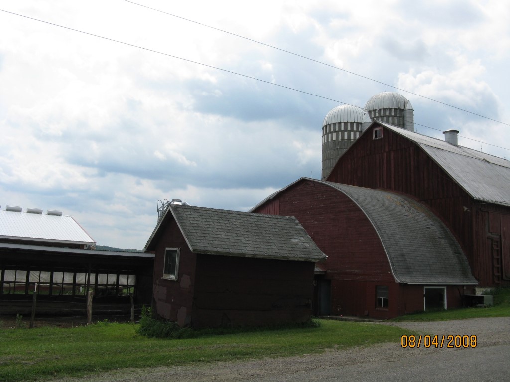
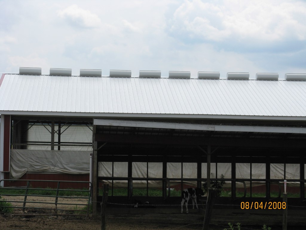
Other Buildings & Yards
Description
Built
Width
Length
Area
BANK BARN
1900
50
40
2000
FOUR SIDE CLOSED MTL POLE BLDG
1980
24
22
528
ATTACHED CB MILK HOUSE
1900
20
20
400
FLAT BARN
1900
20
20
400
CONCRETE STAVE WITH ROOF
1900
20
50
15700
CONCRETE STAVE WITH ROOF
1900
20
60
18840
FOUR SIDE WD POLE BLDG
2003
40
50
2000
ONE SIDE OPEN MTL POLE BLDG
2008
48
100
4800
FOUR SIDE OPEN MTL POLE BLDG
2005
10
40
400
Sales History
Sale Date
Type
Price
Book / Page
Other Info
3/21/1990
0
0116 / 0379
Parcel Sketches
Invalid Parcel Number or No Sketches on File
Parcel Images
Please note:
this tab is for informational purposes only and may not show all delinquencies, see the Taxes tab for more accurate delinquent taxes due.