Elected Officials
Courts
Departments
Initiatives
Open Government
About
Login / Register
Home
/
Property & Tax Records
/
Property Records
/
Property & Tax Search
/
Parcel Profile
/
Print View
Search for Another Parcel
Parcel Profile
Historical Card
Sketches
Photos
Tax Map
Taxes
Print View
Print This Page
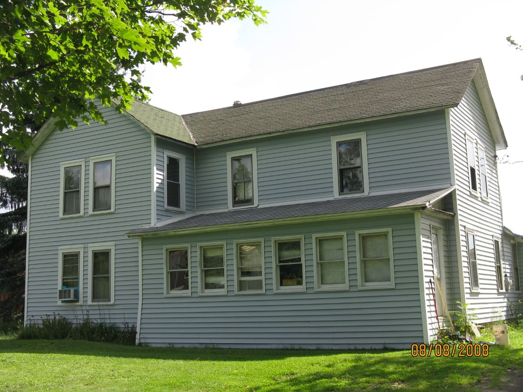
Address: 21313 SPARTANSBURG HWY
Parcel: 03013040000201
Parcel Profile
Address
21313 | SPARTANSBURG | HWY
Street Status
PAVED
School District
CORRY AREA SCHOOL
Acreage
2.9400
Classification
R
Land Use Code
SINGLE FAMILY
Legal Description
21313 SPARTANSBURG HWY 2.945
Square Feet
2626
Topo
LEVEL
Utility
WELL | SEPTIC
Zoning
Please contact your municipal zoning officer
Deed Book
2011
Deed Page
026881
2026 Tax Values
Land Value / Taxable
12,500 / 12,500.00
Building Value / Taxable
83,100 / 83,100.00
Total Value / Taxable
95,600 / 95,600.00
Clean & Green
Inactive
Homestead Status
Inactive
Farmstead Status
Inactive
Lerta Amount
0
Lerta Expiration Year
0
Residential Data
Card 1
Style
OLD STYLE
Basement
PART
Year Built
1900
Exterior Wall
ALUMINUM/VINYL
Total Living Area
2626
Full Baths
1
Half Baths
0
Fuel Type
COAL/WOOD
Heating
CENTRAL
Heating System
FORCED AIR
Stories
2.0
Total Bedrooms
4
Total Family Rooms
0
Total Rooms
8
Fireplaces
0
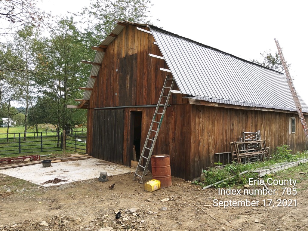
Other Buildings & Yards
Description
Built
Width
Length
Area
FLAT BARN
1980
22
24
528
FLAT BARN
2021
24
40
960
Sales History
Sale Date
Type
Price
Book / Page
Other Info
11/8/2011
LAND & BUILDING
25000
2011 / 026881
SPECIAL WARRANTY DEED
2/7/2011
LAND & BUILDING
0
2011 / 003302
SHERIFF'S DED
11/3/2004
LAND & BUILDING
57900
1186 / 1795
WARRANTY/SURVIVORSHIP DEED
6/24/1999
0
0645 / 0609
Parcel Sketches
Residential Card 1
A
MAIN
929 square feet
B
OFP OPEN FRAME PORCH
240 square feet
C
1S FR ONE STORY FRAME
768 square feet
D
EFP ENCL FRAME PORCH
60 square feet
E
EFP ENCL FRAME PORCH
217 square feet
Parcel Images
Please note:
this tab is for informational purposes only and may not show all delinquencies, see the Taxes tab for more accurate delinquent taxes due.