Elected Officials
Courts
Departments
Initiatives
Open Government
About
Login / Register
Home
/
Property & Tax Records
/
Property Records
/
Property & Tax Search
/
Parcel Profile
/
Print View
Search for Another Parcel
Parcel Profile
Historical Card
Sketches
Photos
Tax Map
Taxes
Print View
Print This Page
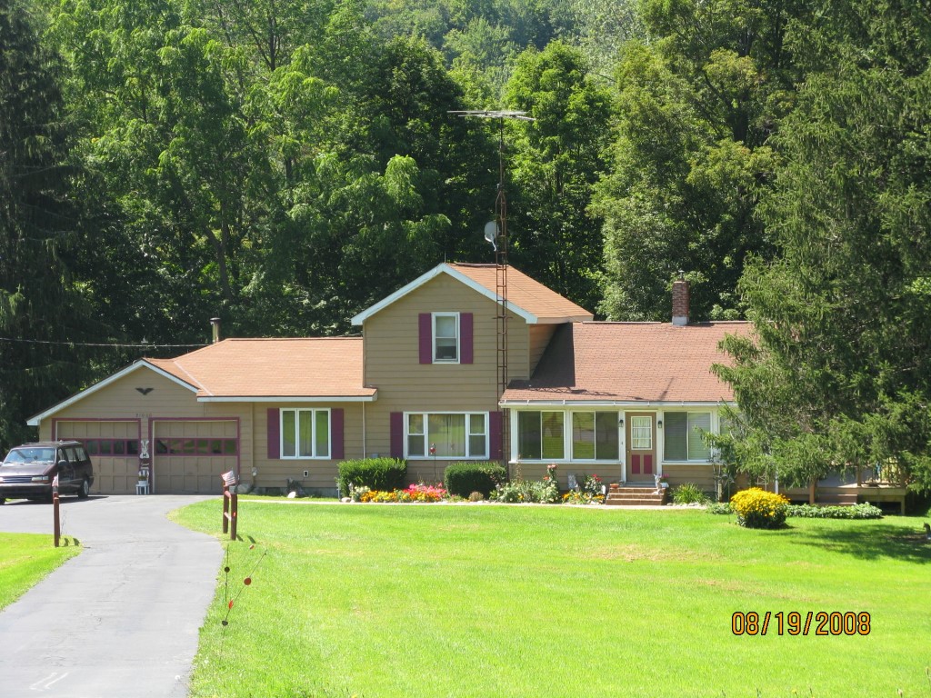
Address: 21000 SPARTANSBURG HWY
Parcel: 03014037000300
Parcel Profile
Address
21000 | SPARTANSBURG | HWY
Street Status
PAVED
School District
CORRY AREA SCHOOL
Acreage
9.5900
Classification
R
Land Use Code
SINGLE FAMILY
Legal Description
21000 SPARTANSBURG HGWY 9.59 A
Square Feet
1832
Topo
ROLLING | STEEP
Utility
SEPTIC | WELL
Zoning
Please contact your municipal zoning officer
Deed Book
1097
Deed Page
2007
2026 Tax Values
Land Value / Taxable
19,800 / 19,800.00
Building Value / Taxable
98,400 / 98,400.00
Total Value / Taxable
118,200 / 118,200.00
Clean & Green
Inactive
Homestead Status
Active
Farmstead Status
Inactive
Lerta Amount
0
Lerta Expiration Year
0
Residential Data
Card 1
Style
OLD STYLE
Basement
FULL
Year Built
1880
Exterior Wall
ALUMINUM/VINYL
Total Living Area
1832
Full Baths
1
Half Baths
0
Fuel Type
OIL
Heating
CENTRAL
Heating System
HOT WATER
Stories
2.0
Total Bedrooms
4
Total Family Rooms
0
Total Rooms
7
Fireplaces
0
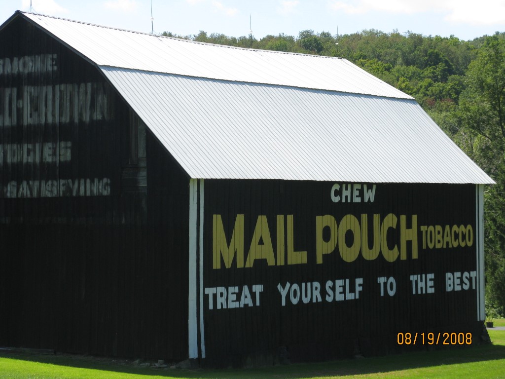
Other Buildings & Yards
Description
Built
Width
Length
Area
FLAT BARN
1880
42
60
2520
1S LEAN TO
2006
10
12
120
Sales History
Sale Date
Type
Price
Book / Page
Other Info
12/30/2003
LAND & BUILDING
0
1097 / 2007
QUIT CLAIM DEED
11/24/1999
0
0675 / 1325
Parcel Sketches
Residential Card 1
A
MAIN
448 square feet
B
MA STOOP/TERR MAS STOOP
20 square feet
C
UNFIN BSMT BASEMENT UNFINISHED 1S FR ONE STORY FRAME
600 square feet
D
EFP ENCL FRAME PORCH
200 square feet
E
1S FR ONE STORY FRAME
336 square feet
F
FR GR FRAME GARAGE
550 square feet
Parcel Images
Please note:
this tab is for informational purposes only and may not show all delinquencies, see the Taxes tab for more accurate delinquent taxes due.