Elected Officials
Courts
Departments
Initiatives
Open Government
About
Login / Register
Home
/
Property & Tax Records
/
Property Records
/
Property & Tax Search
/
Parcel Profile
/
Print View
Search for Another Parcel
Parcel Profile
Historical Card
Sketches
Photos
Tax Map
Taxes
Print View
Print This Page
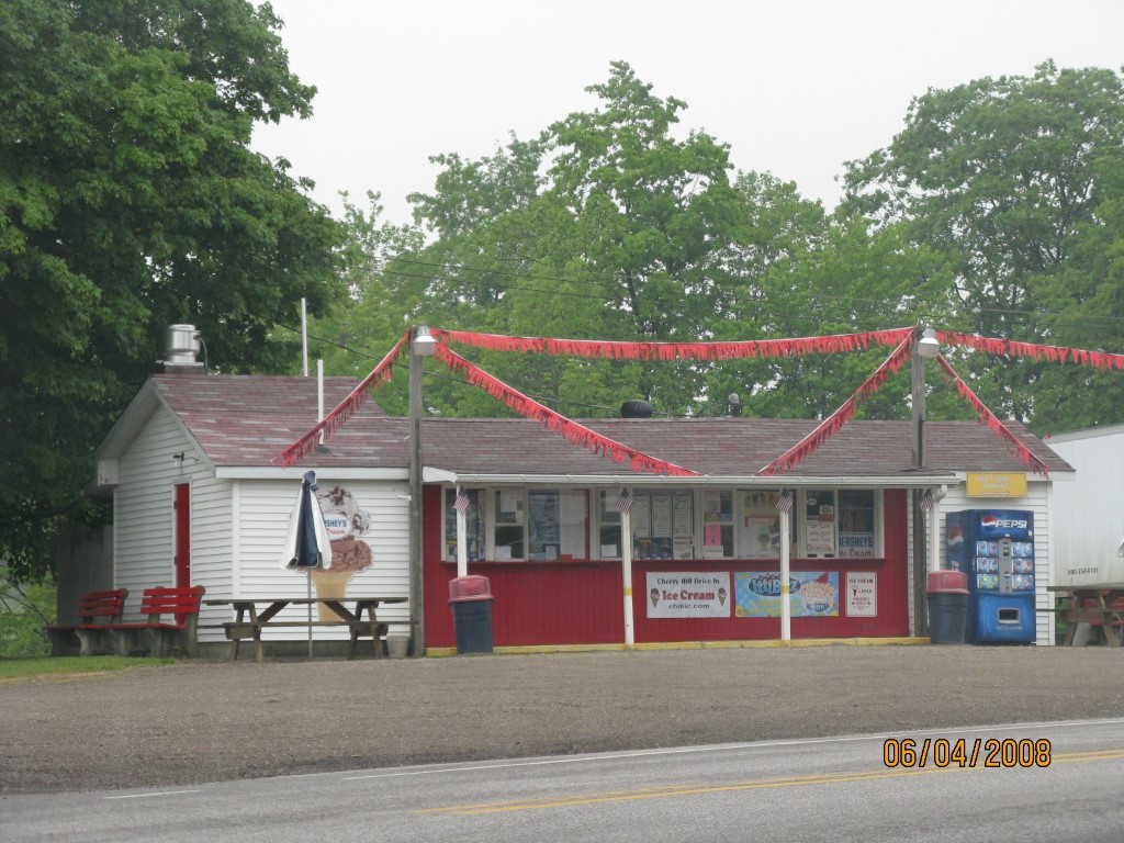
Address: 8915 ROUTE 6N
Parcel: 04011031000100
Parcel Profile
Address
8915 | ROUTE 6N
Street Status
PAVED
School District
NORTHWESTERN SCHOOL
Acreage
1.0000
Classification
C
Land Use Code
RESTAURANTS, STORES (RETAIL)
Legal Description
8915 ROUTE 6N 1 AC
Square Feet
760
Topo
LEVEL
Utility
GAS | WELL | SEPTIC
Zoning
Please contact your municipal zoning officer
Deed Book
2020
Deed Page
016391
2026 Tax Values
Land Value / Taxable
21,800 / 21,800.00
Building Value / Taxable
27,900 / 27,900.00
Total Value / Taxable
49,700 / 49,700.00
Clean & Green
Inactive
Homestead Status
Inactive
Farmstead Status
Inactive
Lerta Amount
0
Lerta Expiration Year
0
Commercial Data
Card 1
RETAIL DRIVE-UP
Business Living Area - 760
Year Built - 1959
Improvement Name - CHERRY HILL DRIVE IN
Value - 27860
Other Buildings & Yards
No OBY Data Found
Sales History
Sale Date
Type
Price
Book / Page
Other Info
8/20/2020
LAND & BUILDING
56500
2020 / 016391
SPECIAL WARRANTY DEED
3/26/2018
LAND & BUILDING
30000
2018 / 005414
DEED
6/18/2002
LAND & BUILDING
58200
890 / 2139
DEED
1/16/1998
LAND & BUILDING
43900
538 / 1645
Parcel Sketches
Commercial Card 1
A
MAIN
760 square feet
Parcel Images
Please note:
this tab is for informational purposes only and may not show all delinquencies, see the Taxes tab for more accurate delinquent taxes due.