Elected Officials
Courts
Departments
Initiatives
Open Government
About
Login / Register
Home
/
Property & Tax Records
/
Property Records
/
Property & Tax Search
/
Parcel Profile
/
Print View
Search for Another Parcel
Parcel Profile
Historical Card
Sketches
Photos
Tax Map
Taxes
Print View
Print This Page
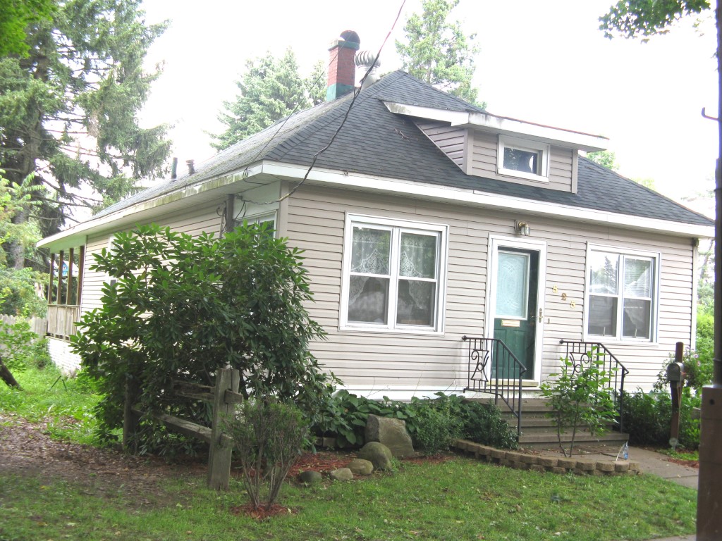
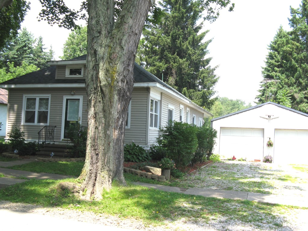
Address: 525 LIBERTY ST
Parcel: 05021104100600
Parcel Profile
Address
525 | LIBERTY | ST
Street Status
PAVED
School District
CORRY AREA SCHOOL
Acreage
0.2500
Classification
R
Land Use Code
SINGLE FAMILY
Legal Description
525 LIBERTY ST 66 X 165
Square Feet
768
Topo
LEVEL
Utility
ALL PUBLIC
Zoning
Please contact your municipal zoning officer
Deed Book
0938
Deed Page
0324
2026 Tax Values
Land Value / Taxable
6,700 / 6,700.00
Building Value / Taxable
31,600 / 31,600.00
Total Value / Taxable
38,300 / 38,300.00
Clean & Green
Inactive
Homestead Status
Active
Farmstead Status
Inactive
Lerta Amount
0
Lerta Expiration Year
0
Residential Data
Card 1
Style
BUNGALOW
Basement
FULL
Year Built
1916
Exterior Wall
ALUMINUM/VINYL
Total Living Area
768
Full Baths
1
Half Baths
0
Fuel Type
GAS
Heating
CENTRAL
Heating System
FORCED AIR
Stories
1.0
Total Bedrooms
1
Total Family Rooms
1
Total Rooms
4
Fireplaces
0
Other Buildings & Yards
No OBY Data Found
Sales History
Sale Date
Type
Price
Book / Page
Other Info
10/28/2002
LAND & BUILDING
54900
0938 / 0324
DEED
12/15/1999
0
0678 / 1419
Parcel Sketches
Residential Card 1
A
MAIN
768 square feet
B
WDDCK WOOD DECKS
170 square feet
C
EFP ENCL FRAME PORCH
108 square feet
D
MA STOOP/TERR MAS STOOP
63 square feet
E
EFP ENCL FRAME PORCH
45 square feet
Parcel Images
Please note:
this tab is for informational purposes only and may not show all delinquencies, see the Taxes tab for more accurate delinquent taxes due.