Elected Officials
Courts
Departments
Initiatives
Open Government
About
Login / Register
Home
/
Property & Tax Records
/
Property Records
/
Property & Tax Search
/
Parcel Profile
/
Print View
Search for Another Parcel
Parcel Profile
Historical Card
Sketches
Photos
Tax Map
Taxes
Print View
Print This Page
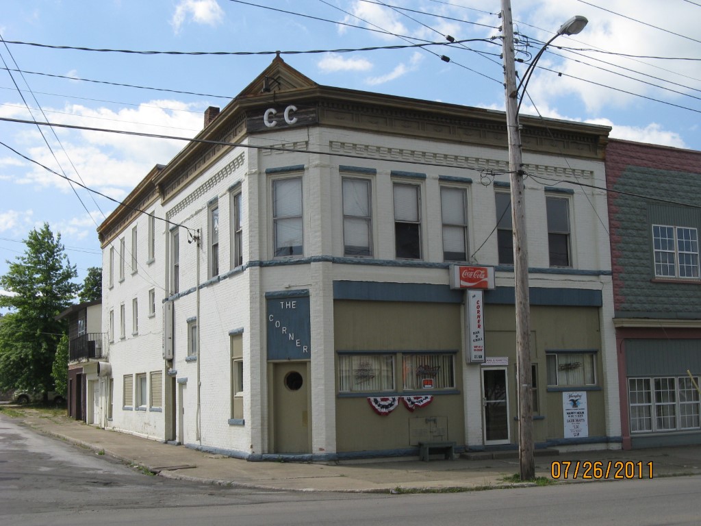
Address: 32 E MAIN ST
Parcel: 05027169000900
Parcel Profile
Address
32 | E | MAIN | ST
Street Status
PAVED | SIDEWALK
School District
CORRY AREA SCHOOL
Acreage
0.0663
Classification
C
Land Use Code
OFFICE BLDGS/LABS/LIBRARIES
Legal Description
32 E MAIN ST L 7 33X87.5
Square Feet
4752
Topo
LEVEL
Utility
ALL PUBLIC
Zoning
Please contact your municipal zoning officer
Deed Book
2021
Deed Page
006574
2026 Tax Values
Land Value / Taxable
2,900 / 2,900.00
Building Value / Taxable
56,600 / 56,600.00
Total Value / Taxable
59,500 / 59,500.00
Clean & Green
Inactive
Homestead Status
Inactive
Farmstead Status
Inactive
Lerta Amount
0
Lerta Expiration Year
0
Commercial Data
Card 1
BAR/LOUNGE
Business Living Area - 4752
Year Built - 1900
Improvement Name - CLIFF'S TAVERN
Value - 102880
Other Buildings & Yards
No OBY Data Found
Sales History
Sale Date
Type
Price
Book / Page
Other Info
3/19/2021
LAND & BUILDING
70000
2021 / 006574
SPECIAL WARRANTY DEED
4/15/2002
LAND & BUILDING
45000
0871 / 0518
Parcel Sketches
Commercial Card 1
A
MAIN
1188 square feet
B
MAIN
2376 square feet
C
MAIN
2376 square feet
Parcel Images
Please note:
this tab is for informational purposes only and may not show all delinquencies, see the Taxes tab for more accurate delinquent taxes due.