Elected Officials
Courts
Departments
Initiatives
Open Government
About
Login / Register
Home
/
Property & Tax Records
/
Property Records
/
Property & Tax Search
/
Parcel Profile
/
Print View
Search for Another Parcel
Parcel Profile
Historical Card
Sketches
Photos
Tax Map
Taxes
Print View
Print This Page
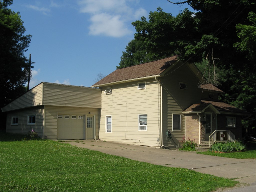
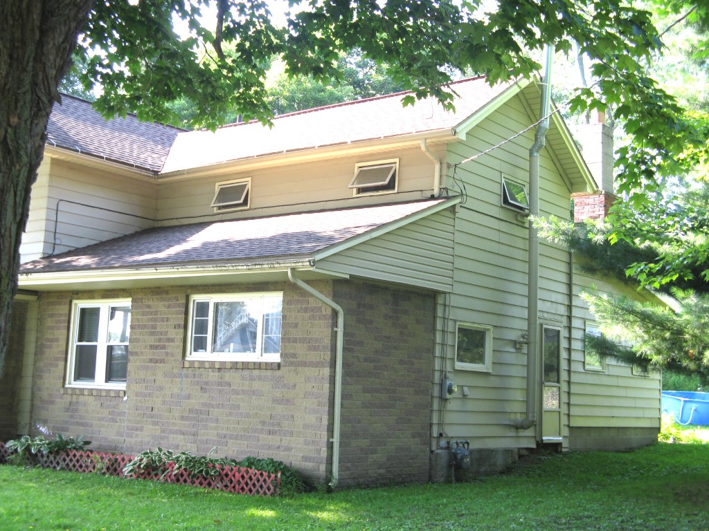
Address: 542 LIBERTY ST
Parcel: 05028103000700
Parcel Profile
Address
542 | LIBERTY | ST
Street Status
PAVED | SIDEWALK
School District
CORRY AREA SCHOOL
Acreage
0.2143
Classification
R
Land Use Code
SINGLE FAMILY
Legal Description
542 LIBERTY ST TR 52 81 X 115.25
Square Feet
1872
Topo
LEVEL
Utility
ALL PUBLIC
Zoning
Please contact your municipal zoning officer
Deed Book
1297
Deed Page
0991
2026 Tax Values
Land Value / Taxable
6,500 / 6,500.00
Building Value / Taxable
62,600 / 62,600.00
Total Value / Taxable
69,100 / 69,100.00
Clean & Green
Inactive
Homestead Status
Active
Farmstead Status
Inactive
Lerta Amount
0
Lerta Expiration Year
0
Residential Data
Card 1
Style
OLD STYLE
Basement
PART
Year Built
1910
Exterior Wall
ALUMINUM/VINYL
Total Living Area
1872
Full Baths
1
Half Baths
0
Fuel Type
GAS
Heating
CENTRAL
Heating System
FORCED AIR
Stories
2.0
Total Bedrooms
4
Total Family Rooms
0
Total Rooms
8
Fireplaces
1
Other Buildings & Yards
No OBY Data Found
Sales History
Sale Date
Type
Price
Book / Page
Other Info
12/30/2005
LAND & BUILDING
75000
1297 / 0991
DEED
7/16/1993
0
0280 / 1020
Parcel Sketches
Residential Card 1
A
MAIN
686 square feet
B
FR GR FRAME GARAGE
594 square feet
C
FR UT FRAME UTILITY BUILDING
90 square feet
D
CANPY CANOPY
105 square feet
E
1S FR ONE STORY FRAME
470 square feet
F
EMP ENCL MASONRY PORCH
176 square feet
G
1SMAS MASONRY
30 square feet
H
MA_PT CONC/MAS PATIO
24 square feet
Parcel Images
Please note:
this tab is for informational purposes only and may not show all delinquencies, see the Taxes tab for more accurate delinquent taxes due.