Elected Officials
Courts
Departments
Initiatives
Open Government
About
Login / Register
Home
/
Property & Tax Records
/
Property Records
/
Property & Tax Search
/
Parcel Profile
/
Print View
Search for Another Parcel
Parcel Profile
Historical Card
Sketches
Photos
Tax Map
Taxes
Print View
Print This Page
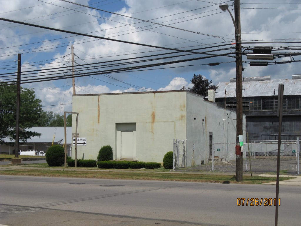
Address: 401 E MAIN ST
Parcel: 05028113000100
Parcel Profile
Address
401 | E | MAIN | ST
Street Status
PAVED
School District
CORRY AREA SCHOOL
Acreage
0.1761
Classification
C
Land Use Code
WAREHOUSES
Legal Description
401 E MAIN ST TR 52 56 X 137
Square Feet
1980
Topo
ROLLING
Utility
ALL PUBLIC
Zoning
Please contact your municipal zoning officer
Deed Book
0976
Deed Page
0436
2026 Tax Values
Land Value / Taxable
7,700 / 7,700.00
Building Value / Taxable
28,300 / 28,300.00
Total Value / Taxable
36,000 / 36,000.00
Clean & Green
Inactive
Homestead Status
Inactive
Farmstead Status
Inactive
Lerta Amount
0
Lerta Expiration Year
0
Commercial Data
Card 1
WAREHOUSE
Business Living Area - 1980
Year Built - 1970
Improvement Name - WAREHOUSE
Value - 28270
Other Buildings & Yards
No OBY Data Found
Sales History
Sale Date
Type
Price
Book / Page
Other Info
2/12/2003
LAND & BUILDING
0
0976 / 0436
AFFIDAVIT
3/1/1973
0
1090 / 0093
Parcel Sketches
Commercial Card 1
A
MAIN
1980 square feet
Parcel Images
Please note:
this tab is for informational purposes only and may not show all delinquencies, see the Taxes tab for more accurate delinquent taxes due.