Elected Officials
Courts
Departments
Initiatives
Open Government
About
Login / Register
Home
/
Property & Tax Records
/
Property Records
/
Property & Tax Search
/
Parcel Profile
/
Print View
Search for Another Parcel
Parcel Profile
Historical Card
Sketches
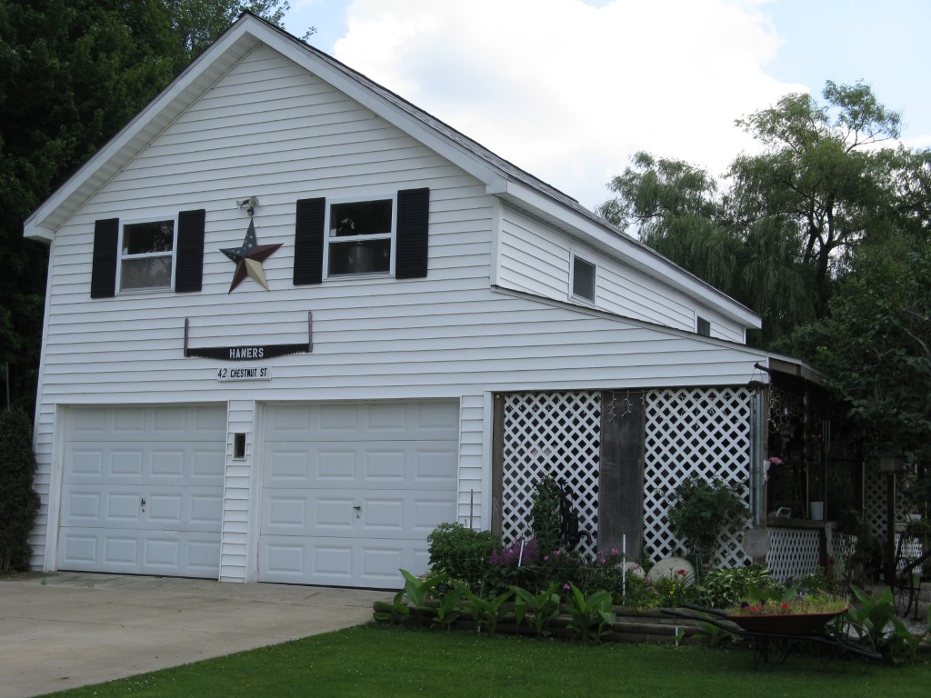
Photos
Tax Map
Taxes
Print View
Print This Page
Address: CHESTNUT ST
Parcel: 05032161004000
Parcel Profile
Address
0 | CHESTNUT | ST
Street Status
PAVED
School District
CORRY AREA SCHOOL
Acreage
0.1534
Classification
R
Land Use Code
OUTBUILDINGS ONLY; NO LIVING UNITS
Legal Description
CHESTNUT ST TR 52 | 45 X 148.2
Topo
ABOVE STREET
Utility
ALL PUBLIC
Zoning
Please contact your municipal zoning officer
Deed Book
0589
Deed Page
2111
2026 Tax Values
Land Value / Taxable
4,700 / 4,700.00
Building Value / Taxable
10,100 / 10,100.00
Total Value / Taxable
14,800 / 14,800.00
Clean & Green
Inactive
Homestead Status
Inactive
Farmstead Status
Inactive
Lerta Amount
0
Lerta Expiration Year
0
Other Buildings & Yards
No OBY Data Found
Sales History
Sale Date
Type
Price
Book / Page
Other Info
9/18/1998
LAND & BUILDING
32000
0589 / 2111
7/5/1996
0
0449 / 0486
Parcel Sketches
Invalid Parcel Number or No Sketches on File
Parcel Images
Please note:
this tab is for informational purposes only and may not show all delinquencies, see the Taxes tab for more accurate delinquent taxes due.