Elected Officials
Courts
Departments
Initiatives
Open Government
About
Login / Register
Home
/
Property & Tax Records
/
Property Records
/
Property & Tax Search
/
Parcel Profile
/
Print View
Search for Another Parcel
Parcel Profile
Historical Card
Sketches
Photos
Tax Map
Taxes
Print View
Print This Page
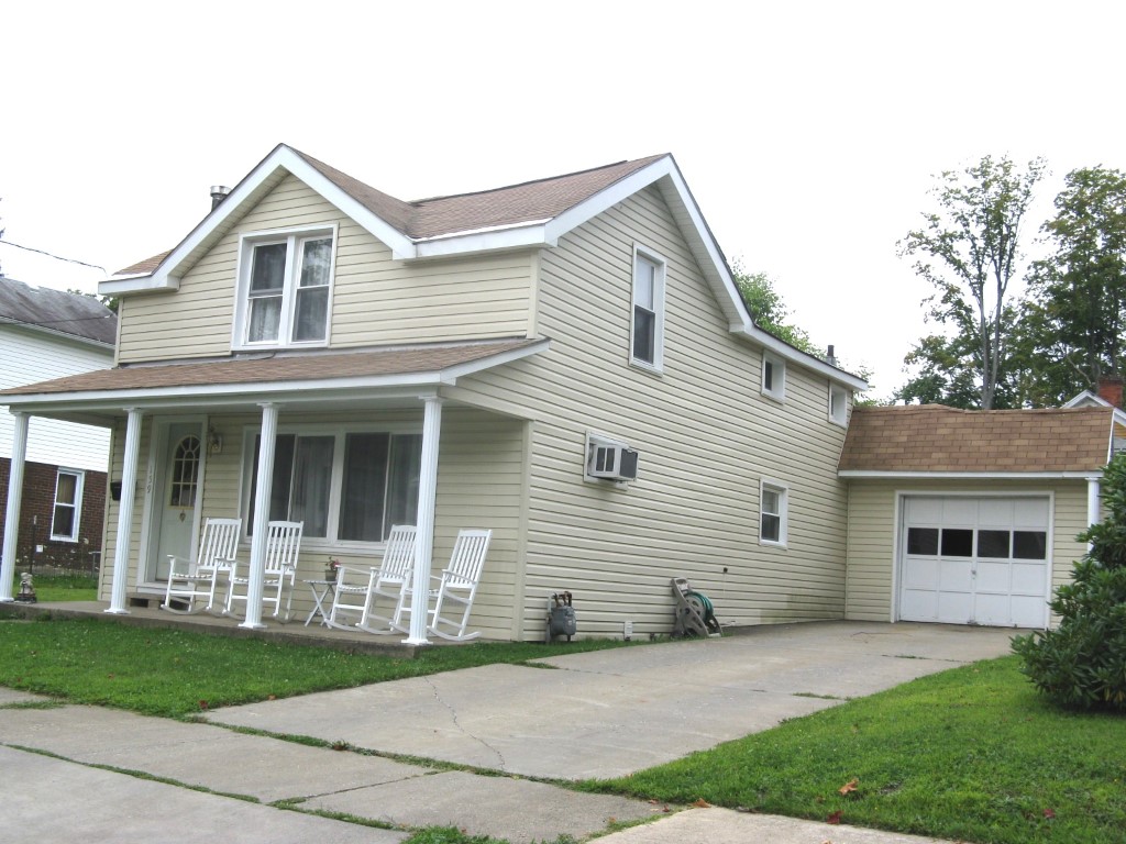
Address: 159 WRIGHT ST
Parcel: 06022097000500
Parcel Profile
Address
159 | WRIGHT | ST
Street Status
PAVED
School District
CORRY AREA SCHOOL
Acreage
0.1721
Classification
R
Land Use Code
SINGLE FAMILY
Legal Description
159 WRIGHT ST 75 X 100
Square Feet
1920
Topo
LEVEL
Utility
ALL PUBLIC
Zoning
Please contact your municipal zoning officer
Deed Book
2022
Deed Page
001855
2026 Tax Values
Land Value / Taxable
12,100 / 12,100.00
Building Value / Taxable
60,800 / 60,800.00
Total Value / Taxable
72,900 / 72,900.00
Clean & Green
Inactive
Homestead Status
Active
Farmstead Status
Inactive
Lerta Amount
0
Lerta Expiration Year
0
Residential Data
Card 1
Style
OLD STYLE
Basement
FULL
Year Built
1900
Exterior Wall
ALUMINUM/VINYL
Total Living Area
1920
Full Baths
1
Half Baths
0
Fuel Type
GAS
Heating
CENTRAL
Heating System
HOT WATER
Stories
2.0
Total Bedrooms
4
Total Family Rooms
0
Total Rooms
7
Fireplaces
0
Other Buildings & Yards
No OBY Data Found
Sales History
Sale Date
Type
Price
Book / Page
Other Info
1/27/2022
LAND & BUILDING
0
2022 / 001855
SPECIAL WARRANTY DEED
10/9/1990
0
0139 / 1939
Parcel Sketches
Residential Card 1
A
MAIN
704 square feet
B
OFP OPEN FRAME PORCH
144 square feet
C
FR GR FRAME GARAGE
368 square feet
D
OFP OPEN FRAME PORCH
105 square feet
E
1S FR ONE STORY FRAME
512 square feet
F
OFP OPEN FRAME PORCH
85 square feet
Parcel Images
Please note:
this tab is for informational purposes only and may not show all delinquencies, see the Taxes tab for more accurate delinquent taxes due.