Elected Officials
Courts
Departments
Initiatives
Open Government
About
Login / Register
Home
/
Property & Tax Records
/
Property Records
/
Property & Tax Search
/
Parcel Profile
/
Print View
Search for Another Parcel
Parcel Profile
Historical Card
Sketches
Photos
Tax Map
Taxes
Print View
Print This Page
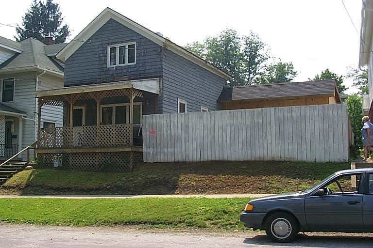
Address: 149 WRIGHT ST
Parcel: 06022097000900
Parcel Profile
Address
149 | WRIGHT | ST
Street Status
PAVED
School District
CORRY AREA SCHOOL
Acreage
0.1148
Classification
R
Land Use Code
RES VACANT
Legal Description
149 WRIGHT ST TR 52 50X100
Topo
LEVEL
Utility
ALL PUBLIC
Zoning
Please contact your municipal zoning officer
Deed Book
2024
Deed Page
000407
2026 Tax Values
Land Value / Taxable
11,500 / 11,500.00
Building Value / Taxable
0 / 0.00
Total Value / Taxable
11,500 / 11,500.00
Clean & Green
Inactive
Homestead Status
Inactive
Farmstead Status
Inactive
Lerta Amount
0
Lerta Expiration Year
0
Other Buildings & Yards
No OBY Data Found
Sales History
Sale Date
Type
Price
Book / Page
Other Info
1/8/2024
LAND & BUILDING
500
2024 / 000407
QUIT CLAIM DEED
6/6/2023
LAND & BUILDING
0
2023 / 008745
SPECIAL WARRANTY DEED
1/4/1995
LAND & BUILDING
22000
0368 / 1644
Parcel Sketches
Invalid Parcel Number or No Sketches on File
Parcel Images
Please note:
this tab is for informational purposes only and may not show all delinquencies, see the Taxes tab for more accurate delinquent taxes due.