Elected Officials
Courts
Departments
Initiatives
Open Government
About
Login / Register
Home
/
Property & Tax Records
/
Property Records
/
Property & Tax Search
/
Parcel Profile
/
Print View
Search for Another Parcel
Parcel Profile
Historical Card
Sketches
Photos
Tax Map
Taxes
Print View
Print This Page
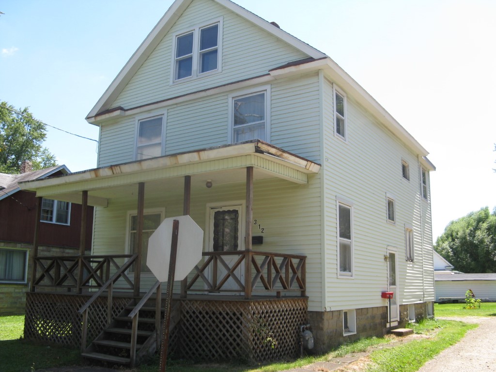
Address: 312 E SMITH ST
Parcel: 06022099000300
Parcel Profile
Address
312 | E | SMITH | ST
Street Status
PAVED
School District
CORRY AREA SCHOOL
Acreage
0.1148
Classification
R
Land Use Code
SINGLE FAMILY
Legal Description
312 E SMITH ST TR 52 50X100
Square Feet
1584
Topo
LEVEL
Utility
ALL PUBLIC
Zoning
Please contact your municipal zoning officer
Deed Book
2023
Deed Page
005481
2026 Tax Values
Land Value / Taxable
11,500 / 11,500.00
Building Value / Taxable
51,590 / 51,590.00
Total Value / Taxable
63,090 / 63,090.00
Clean & Green
Inactive
Homestead Status
Inactive
Farmstead Status
Inactive
Lerta Amount
0
Lerta Expiration Year
0
Residential Data
Card 1
Style
OLD STYLE
Basement
FULL
Year Built
1900
Exterior Wall
ALUMINUM/VINYL
Total Living Area
1584
Full Baths
1
Half Baths
0
Fuel Type
GAS
Heating
CENTRAL
Heating System
FORCED AIR
Stories
2.0
Total Bedrooms
2
Total Family Rooms
0
Total Rooms
7
Fireplaces
0
Other Buildings & Yards
No OBY Data Found
Sales History
Sale Date
Type
Price
Book / Page
Other Info
4/11/2023
LAND & BUILDING
87000
2023 / 005481
SPECIAL WARRANTY DEED
11/25/2020
LAND & BUILDING
59900
2020 / 025546
SPECIAL WARRANTY DEED
9/3/1993
0
0289 / 1511
Parcel Sketches
Residential Card 1
A
MAIN
672 square feet
B
UNFIN BSMT BASEMENT UNFINISHED 1S FR ONE STORY FRAME 1S FR ONE STORY FRAME
120 square feet
C
OFP OPEN FRAME PORCH
192 square feet
Parcel Images
Please note:
this tab is for informational purposes only and may not show all delinquencies, see the Taxes tab for more accurate delinquent taxes due.