Elected Officials
Courts
Departments
Initiatives
Open Government
About
Login / Register
Home
/
Property & Tax Records
/
Property Records
/
Property & Tax Search
/
Parcel Profile
/
Print View
Search for Another Parcel
Parcel Profile
Historical Card
Sketches
Photos
Tax Map
Taxes
Print View
Print This Page
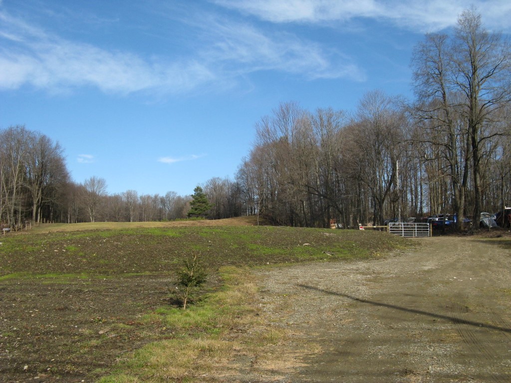
Address: W SMITH ST
Parcel: 07013048001200
Parcel Profile
Address
0 | W | SMITH | ST
Street Status
PAVED
School District
CORRY AREA SCHOOL
Acreage
4.9700
Classification
R
Land Use Code
OUTBUILDINGS ONLY; NO LIVING UNITS
Legal Description
W SMITH ST TR 32 4.97 AC CAL
Topo
ROLLING
Utility
ALL PUBLIC
Zoning
Please contact your municipal zoning officer
Deed Book
2022
Deed Page
004881
2026 Tax Values
Land Value / Taxable
33,000 / 3,700.00
Building Value / Taxable
0 / 0.00
Total Value / Taxable
33,000 / 3,700.00
Clean & Green
Active
Homestead Status
Inactive
Farmstead Status
Inactive
Lerta Amount
0
Lerta Expiration Year
0
Other Buildings & Yards
No OBY Data Found
Sales History
Sale Date
Type
Price
Book / Page
Other Info
3/7/2022
LAND
0
2022 / 004881
DEED
4/5/2019
LAND
0
2019 / 005911
WARRANTY/SURVIVORSHIP DEED
10/20/2014
LAND & BUILDING
82500
2014 / 022486
SPECIAL WARRANTY DEED
10/30/2009
LAND
0
1600 / 0951
QUIT CLAIM DEED
11/6/1987
0
0033 / 0371
Parcel Sketches
Invalid Parcel Number or No Sketches on File
Parcel Images
Please note:
this tab is for informational purposes only and may not show all delinquencies, see the Taxes tab for more accurate delinquent taxes due.