Elected Officials
Courts
Departments
Initiatives
Open Government
About
Login / Register
Home
/
Property & Tax Records
/
Property Records
/
Property & Tax Search
/
Parcel Profile
/
Print View
Search for Another Parcel
Parcel Profile
Historical Card
Sketches
Photos
Tax Map
Taxes
Print View
Print This Page
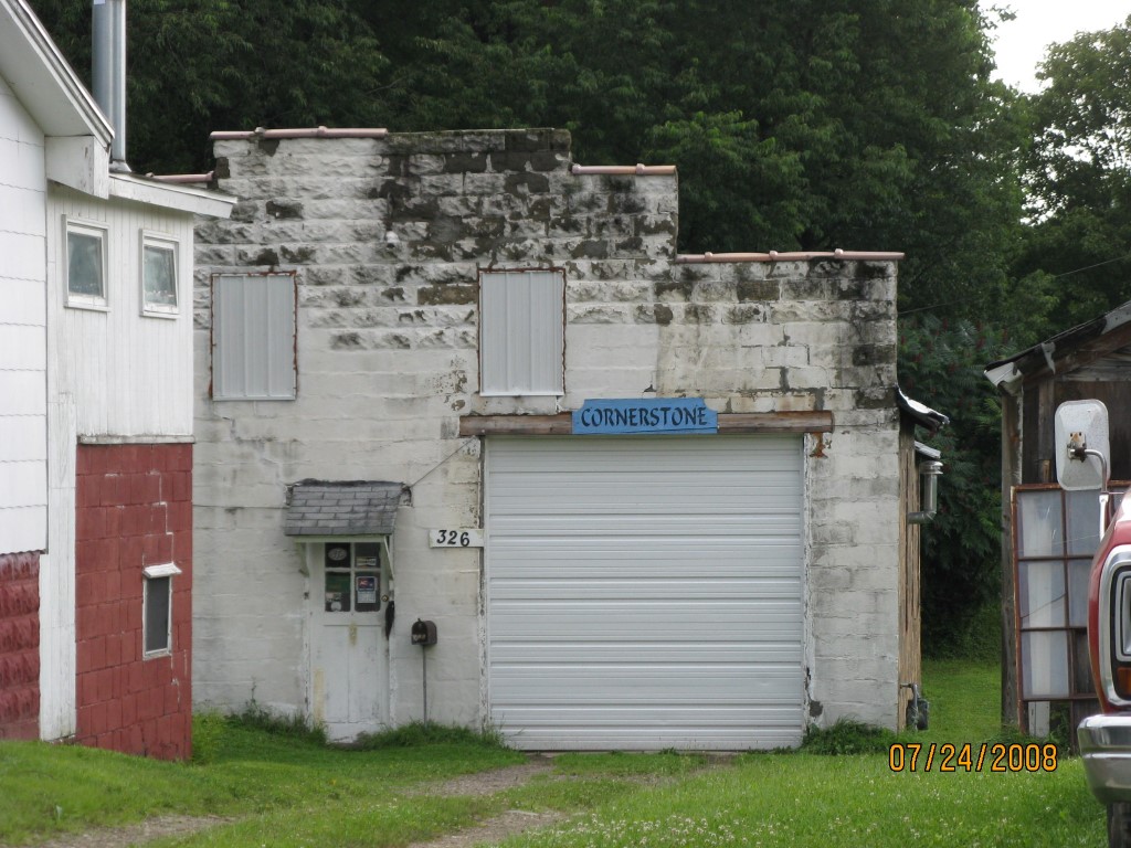
Address: WORTH ST
Parcel: 07023064001600
Parcel Profile
Address
0 | WORTH | ST
Street Status
PAVED
School District
CORRY AREA SCHOOL
Acreage
0.1217
Classification
C
Land Use Code
GARAGES/SHOP/CAR DEALERS
Legal Description
WORTH ST TR 51 | 53X100
Square Feet
1920
Topo
ROLLING
Utility
ALL PUBLIC
Zoning
Please contact your municipal zoning officer
Deed Book
2023
Deed Page
017330
2026 Tax Values
Land Value / Taxable
13,300 / 13,300.00
Building Value / Taxable
13,200 / 13,200.00
Total Value / Taxable
26,500 / 26,500.00
Clean & Green
Inactive
Homestead Status
Inactive
Farmstead Status
Inactive
Lerta Amount
0
Lerta Expiration Year
0
Commercial Data
Card 1
AUTO SERVICE GARAGE
Business Living Area - 1920
Year Built - 1900
Improvement Name - CRAKE AUTO REPAIR
Value - 13200
Other Buildings & Yards
No OBY Data Found
Sales History
Sale Date
Type
Price
Book / Page
Other Info
10/11/2023
LAND & BUILDING
0
2023 / 017330
DEED
8/27/2004
LAND & BUILDING
13000
1167 / 2090
WARRANTY/SURVIVORSHIP DEED
7/26/2002
IMPROVED
7850
904 / 585
DEED
11/8/2001
0
0823 / 2248
Parcel Sketches
Commercial Card 1
A
MAIN
1920 square feet
Parcel Images
Please note:
this tab is for informational purposes only and may not show all delinquencies, see the Taxes tab for more accurate delinquent taxes due.