Elected Officials
Courts
Departments
Initiatives
Open Government
About
Login / Register
Home
/
Property & Tax Records
/
Property Records
/
Property & Tax Search
/
Parcel Profile
/
Print View
Search for Another Parcel
Parcel Profile
Historical Card
Sketches
Photos
Tax Map
Taxes
Print View
Print This Page
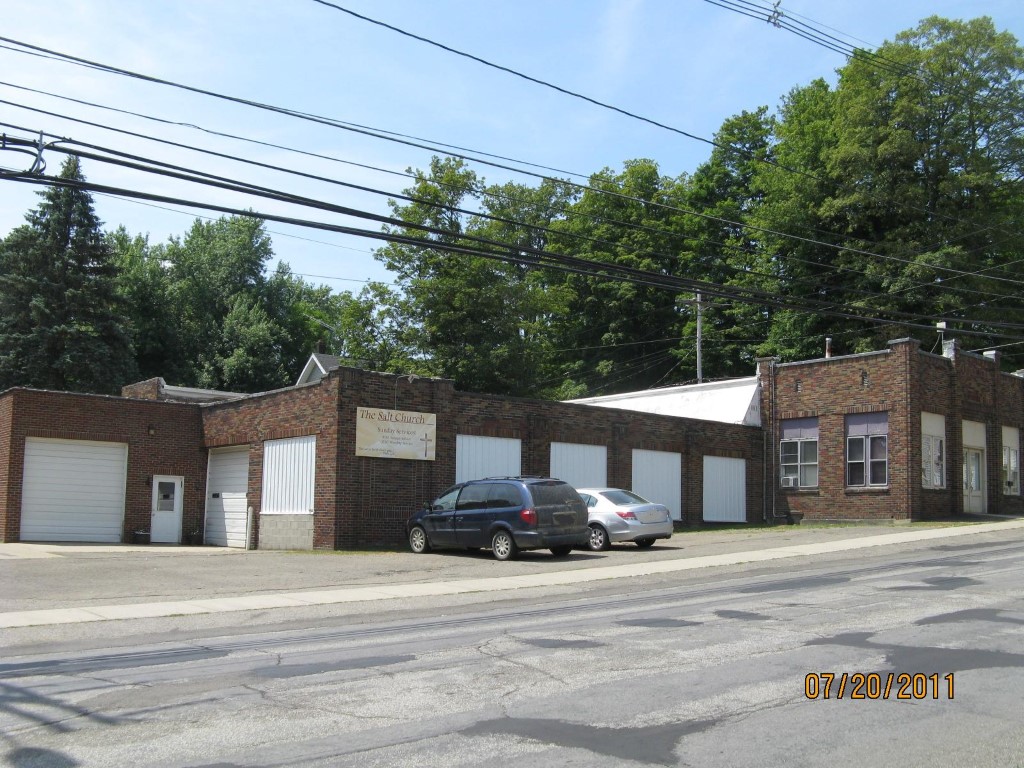
Address: 160 W SMITH ST
Parcel: 07023079000101
Parcel Profile
Address
160 | W | SMITH | ST
Street Status
PAVED
School District
CORRY AREA SCHOOL
Acreage
0.4605
Classification
C
Land Use Code
WAREHOUSES
Legal Description
SMITH ST 125.57 X 73.34 IRR
Square Feet
7479
Topo
ROLLING
Utility
ALL PUBLIC
Zoning
Please contact your municipal zoning officer
Deed Book
2019
Deed Page
018896
2026 Tax Values
Land Value / Taxable
45,100 / 45,100.00
Building Value / Taxable
60,600 / 60,600.00
Total Value / Taxable
105,700 / 105,700.00
Clean & Green
Inactive
Homestead Status
Inactive
Farmstead Status
Inactive
Lerta Amount
0
Lerta Expiration Year
0
Commercial Data
Card 1
OFFICE/WAREHOUSE
Business Living Area - 7479
Year Built - 1910
Improvement Name - K M SANFORD CO
Value - 60640
Other Buildings & Yards
No OBY Data Found
Sales History
Sale Date
Type
Price
Book / Page
Other Info
9/9/2019
LAND & BUILDING
0
2019 / 018896
SPECIAL WARRANTY DEED
11/21/2016
LAND & BUILDING
43500
2016 / 025343
DEED
5/8/2009
LAND & BUILDING
0
1560 / 0953
QUIT CLAIM DEED
7/9/1971
0
1047 / 0534
Parcel Sketches
Commercial Card 1
A
MAIN
7479 square feet
Parcel Images
Please note:
this tab is for informational purposes only and may not show all delinquencies, see the Taxes tab for more accurate delinquent taxes due.