Elected Officials
Courts
Departments
Initiatives
Open Government
About
Login / Register
Home
/
Property & Tax Records
/
Property Records
/
Property & Tax Search
/
Parcel Profile
/
Print View
Search for Another Parcel
Parcel Profile
Historical Card
Sketches
Photos
Tax Map
Taxes
Print View
Print This Page
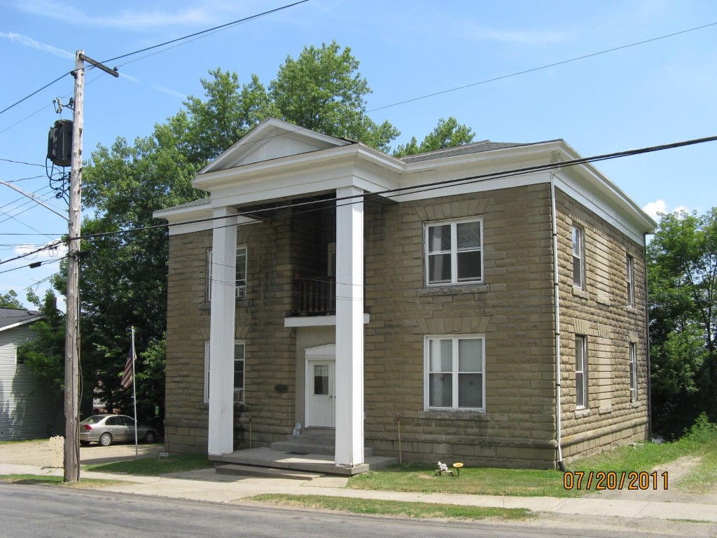
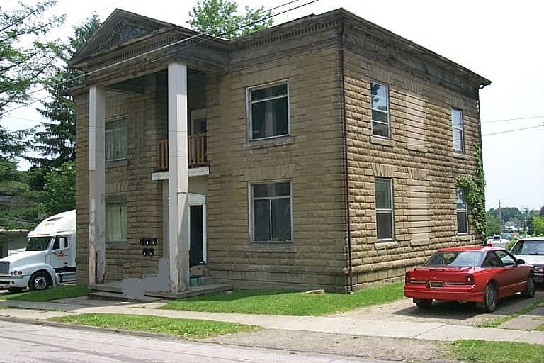
Address: 332 MEAD AVE
Parcel: 07023079000900
Parcel Profile
Address
332 | MEAD | AVE
Street Status
PAVED | SIDEWALK
School District
CORRY AREA SCHOOL
Acreage
0.4522
Classification
A
Land Use Code
APARTMENTS 4 - 19 UNITS
Legal Description
332 MEAD AVE TR 51 100 X 197
Square Feet
4128
Topo
ROLLING
Utility
ALL PUBLIC
Zoning
Please contact your municipal zoning officer
Deed Book
2026
Deed Page
011259
2026 Tax Values
Land Value / Taxable
49,300 / 49,300.00
Building Value / Taxable
51,800 / 51,800.00
Total Value / Taxable
101,100 / 101,100.00
Clean & Green
Inactive
Homestead Status
Inactive
Farmstead Status
Inactive
Lerta Amount
0
Lerta Expiration Year
0
Commercial Data
Card 1
RESIDENTIAL 4 FAMILY
Business Living Area - 4128
Year Built - 1900
Improvement Name -
Value - 51820
Other Buildings & Yards
No OBY Data Found
Sales History
Sale Date
Type
Price
Book / Page
Other Info
6/29/2026
LAND & BUILDING
215000
2026 / 011259
TRUSTEE'S DEED
11/16/2015
LAND & BUILDING
0
2015 / 025427
DEED
7/2/2009
LAND & BUILDING
107500
1573 / 2344
WARRANTY/SURVIVORSHIP DEED
10/1/2003
LAND & BUILDING
47000
1071 / 0245
WARRANTY/SURVIVORSHIP DEED
8/3/1995
LAND & BUILDING
49500
396 / 1325
Parcel Sketches
Commercial Card 1
A
MAIN
1376 square feet
B
MAIN
1376 square feet
C
MAIN
1376 square feet
Parcel Images
Please note:
this tab is for informational purposes only and may not show all delinquencies, see the Taxes tab for more accurate delinquent taxes due.