Elected Officials
Courts
Departments
Initiatives
Open Government
About
Login / Register
Home
/
Property & Tax Records
/
Property Records
/
Property & Tax Search
/
Parcel Profile
/
Print View
Search for Another Parcel
Parcel Profile
Historical Card
Sketches
Photos
Tax Map
Taxes
Print View
Print This Page
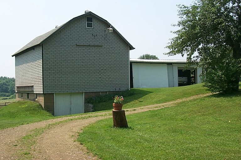
Address: 810 W SMITH ST
Parcel: 07024049000600
Parcel Profile
Address
810 | W | SMITH | ST
Street Status
PAVED
School District
CORRY AREA SCHOOL
Acreage
5.7800
Classification
R
Land Use Code
OUTBUILDINGS ONLY; NO LIVING UNITS
Legal Description
810 W SMITH ST TR 50 5.78 AC
Topo
ROLLING
Utility
ALL PUBLIC
Zoning
Please contact your municipal zoning officer
Deed Book
2022
Deed Page
013611
2026 Tax Values
Land Value / Taxable
31,000 / 4,200.00
Building Value / Taxable
4,900 / 4,900.00
Total Value / Taxable
35,900 / 9,100.00
Clean & Green
Active
Homestead Status
Inactive
Farmstead Status
Inactive
Lerta Amount
0
Lerta Expiration Year
0
Other Buildings & Yards
No OBY Data Found
Sales History
Sale Date
Type
Price
Book / Page
Other Info
6/24/2022
LAND & BUILDING
0
2022 / 013611
DEED
1/30/2012
LAND & BUILDING
144000
2012 / 002505
SPECIAL WARRANTY DEED
2/23/2007
LAND & BUILDING
163000
1396 / 1965
FIDUCIARY DEED
Parcel Sketches
Invalid Parcel Number or No Sketches on File
Parcel Images
Please note:
this tab is for informational purposes only and may not show all delinquencies, see the Taxes tab for more accurate delinquent taxes due.