Elected Officials
Courts
Departments
Initiatives
Open Government
About
Login / Register
Home
/
Property & Tax Records
/
Property Records
/
Property & Tax Search
/
Parcel Profile
/
Print View
Search for Another Parcel
Parcel Profile
Historical Card
Sketches
Photos
Tax Map
Taxes
Print View
Print This Page
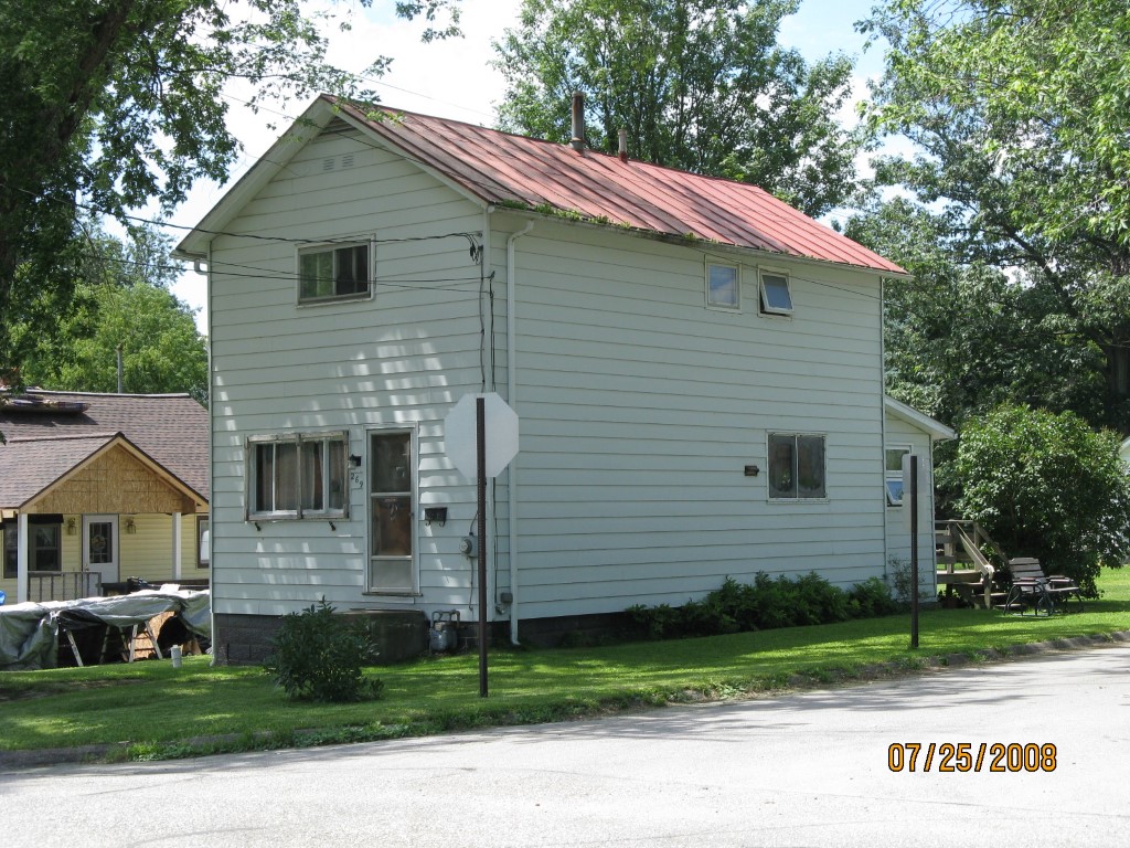
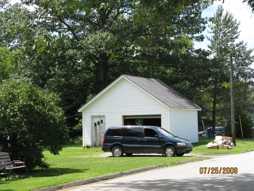
Address: 269 WORTH ST
Parcel: 07025062000100
Parcel Profile
Address
269 | WORTH | ST
Street Status
PAVED
School District
CORRY AREA SCHOOL
Acreage
0.1837
Classification
R
Land Use Code
SINGLE FAMILY
Legal Description
269 WORTH ST TR 51 40X200
Square Feet
960
Topo
LEVEL
Utility
ALL PUBLIC
Zoning
Please contact your municipal zoning officer
Deed Book
0292
Deed Page
0107
2026 Tax Values
Land Value / Taxable
13,400 / 13,400.00
Building Value / Taxable
38,600 / 38,600.00
Total Value / Taxable
52,000 / 52,000.00
Clean & Green
Inactive
Homestead Status
Inactive
Farmstead Status
Inactive
Lerta Amount
0
Lerta Expiration Year
0
Residential Data
Card 1
Style
OLD STYLE
Basement
FULL
Year Built
1920
Exterior Wall
ALUMINUM/VINYL
Total Living Area
960
Full Baths
1
Half Baths
0
Fuel Type
GAS
Heating
CENTRAL
Heating System
FORCED AIR
Stories
2.0
Total Bedrooms
2
Total Family Rooms
0
Total Rooms
5
Fireplaces
0
Other Buildings & Yards
No OBY Data Found
Sales History
Sale Date
Type
Price
Book / Page
Other Info
9/17/1993
0
0292 / 0107
Parcel Sketches
Residential Card 1
A
MAIN
480 square feet
B
EFP ENCL FRAME PORCH
98 square feet
C
WDDCK WOOD DECKS
168 square feet
D
MA STOOP/TERR MAS STOOP
9 square feet
Parcel Images
Please note:
this tab is for informational purposes only and may not show all delinquencies, see the Taxes tab for more accurate delinquent taxes due.