Elected Officials
Courts
Departments
Initiatives
Open Government
About
Login / Register
Home
/
Property & Tax Records
/
Property Records
/
Property & Tax Search
/
Parcel Profile
/
Print View
Search for Another Parcel
Parcel Profile
Historical Card
Sketches
Photos
Tax Map
Taxes
Print View
Print This Page
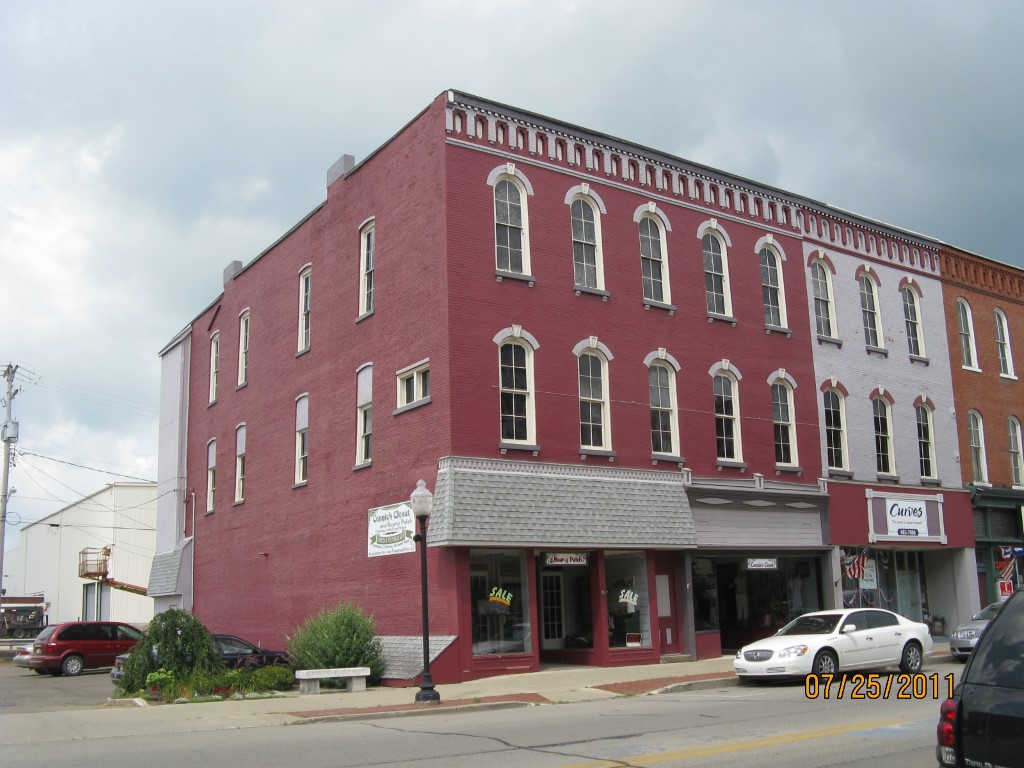
Address: 35 N CENTER ST
Parcel: 07026085000800
Parcel Profile
Address
35 | N | CENTER | ST
Street Status
PAVED
School District
CORRY AREA SCHOOL
Acreage
0.0383
Classification
C
Land Use Code
RESTAURANTS, STORES (RETAIL)
Legal Description
35 N CENTER ST TR 52 21X79.5
Square Feet
6300
Topo
LEVEL
Utility
ALL PUBLIC
Zoning
Please contact your municipal zoning officer
Deed Book
1097
Deed Page
1427
2026 Tax Values
Land Value / Taxable
6,700 / 6,700.00
Building Value / Taxable
30,600 / 30,600.00
Total Value / Taxable
37,300 / 37,300.00
Clean & Green
Inactive
Homestead Status
Inactive
Farmstead Status
Inactive
Lerta Amount
0
Lerta Expiration Year
0
Commercial Data
Card 1
MIXED RES/COMM
Business Living Area - 6300
Year Built - 1900
Improvement Name - THE BEAR-Y PATCH
Value - 45880
Other Buildings & Yards
No OBY Data Found
Sales History
Sale Date
Type
Price
Book / Page
Other Info
12/29/2003
LAND & BUILDING
0
1097 / 1427
SPECIAL WARRANTY DEED
Parcel Sketches
Commercial Card 1
A
MAIN
1575 square feet
B
MAIN
1575 square feet
C
MAIN
1575 square feet
D
MAIN
1575 square feet
Parcel Images
Please note:
this tab is for informational purposes only and may not show all delinquencies, see the Taxes tab for more accurate delinquent taxes due.