Elected Officials
Courts
Departments
Initiatives
Open Government
About
Login / Register
Home
/
Property & Tax Records
/
Property Records
/
Property & Tax Search
/
Parcel Profile
/
Print View
Search for Another Parcel
Parcel Profile
Historical Card
Sketches
Photos
Tax Map
Taxes
Print View
Print This Page
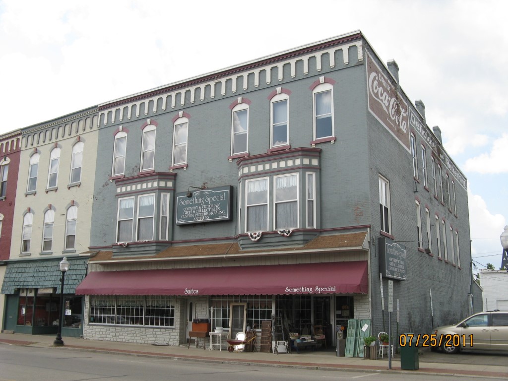
Address: 115 N CENTER ST
Parcel: 07026087000700
Parcel Profile
Address
115 | N | CENTER | ST
Street Status
PAVED
School District
CORRY AREA SCHOOL
Acreage
0.0620
Classification
C
Land Use Code
RESTAURANTS, STORES (RETAIL)
Legal Description
115 N CENTER ST 25 X 108
Square Feet
8650
Topo
LEVEL
Utility
ALL PUBLIC
Zoning
Please contact your municipal zoning officer
Deed Book
2020
Deed Page
027546
2026 Tax Values
Land Value / Taxable
10,800 / 10,800.00
Building Value / Taxable
57,600 / 57,600.00
Total Value / Taxable
68,400 / 68,400.00
Clean & Green
Inactive
Homestead Status
Inactive
Farmstead Status
Inactive
Lerta Amount
0
Lerta Expiration Year
0
Commercial Data
Card 1
MIXED RES/COMM
Business Living Area - 8650
Year Built - 1900
Improvement Name - SOMETHING SPECIAL
Value - 91020
Other Buildings & Yards
No OBY Data Found
Sales History
Sale Date
Type
Price
Book / Page
Other Info
12/21/2020
LAND & BUILDING
157500
2020 / 027546
SPECIAL WARRANTY DEED
11/7/1995
LAND & BUILDING
0
411 / 2359
Parcel Sketches
Commercial Card 1
A
MAIN
2050 square feet
B
MAIN
2050 square feet
C
MAIN
2050 square feet
D
MAIN
450 square feet
E
MAIN
2050 square feet
Parcel Images
Please note:
this tab is for informational purposes only and may not show all delinquencies, see the Taxes tab for more accurate delinquent taxes due.