Elected Officials
Courts
Departments
Initiatives
Open Government
About
Login / Register
Home
/
Property & Tax Records
/
Property Records
/
Property & Tax Search
/
Parcel Profile
/
Print View
Search for Another Parcel
Parcel Profile
Historical Card
Sketches
Photos
Tax Map
Taxes
Print View
Print This Page
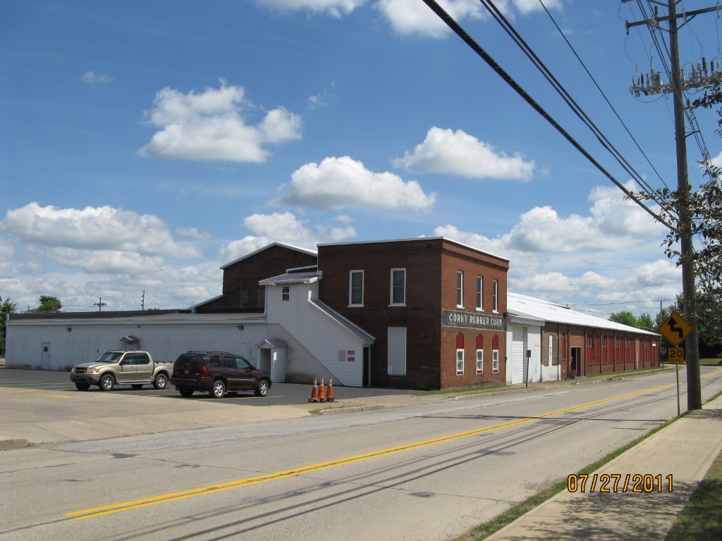
Address: 405 W MAIN ST
Parcel: 08033116000200
Parcel Profile
Address
405 | W | MAIN | ST
Street Status
PAVED | SIDEWALK
School District
CORRY AREA SCHOOL
Acreage
1.1700
Classification
I
Land Use Code
LIGHT INDUSTRIAL
Legal Description
405 W MAIN ST TR 51 1.17 AC CA
Square Feet
41266
Topo
LEVEL
Utility
ALL PUBLIC
Zoning
Please contact your municipal zoning officer
Deed Book
1305
Deed Page
0291
2026 Tax Values
Land Value / Taxable
51,000 / 51,000.00
Building Value / Taxable
136,000 / 136,000.00
Total Value / Taxable
187,000 / 187,000.00
Clean & Green
Inactive
Homestead Status
Inactive
Farmstead Status
Inactive
Lerta Amount
0
Lerta Expiration Year
0
Commercial Data
Card 1
MFG/PROCESSING
Business Living Area - 41266
Year Built - 1900
Improvement Name - CORRY RUBBER CO
Value - 228920
Other Buildings & Yards
No OBY Data Found
Sales History
Sale Date
Type
Price
Book / Page
Other Info
5/19/1978
0
1305 / 0291
Parcel Sketches
Commercial Card 1
A
MAIN
11616 square feet
B
MAIN
5280 square feet
C
MAIN
12524 square feet
D
MAIN
1008 square feet
E
MAIN
1008 square feet
F
MAIN
5488 square feet
G
MAIN
2480 square feet
H
MAIN
1862 square feet
Parcel Images
Please note:
this tab is for informational purposes only and may not show all delinquencies, see the Taxes tab for more accurate delinquent taxes due.