Elected Officials
Courts
Departments
Initiatives
Open Government
About
Login / Register
Home
/
Property & Tax Records
/
Property Records
/
Property & Tax Search
/
Parcel Profile
/
Print View
Search for Another Parcel
Parcel Profile
Historical Card
Sketches
Photos
Tax Map
Taxes
Print View
Print This Page
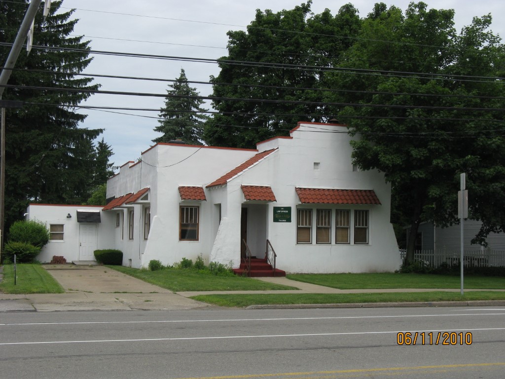
Address: 201 ERIE ST
Parcel: 11003031004900
Parcel Profile
Address
201 | ERIE | ST
Street Status
PAVED | SIDEWALK
School District
GENERAL MCLANE SCHOOL
Acreage
0.2171
Classification
C
Land Use Code
OFFICE BLDGS/LABS/LIBRARIES
Legal Description
ERIE ST 60X157.59
Square Feet
3509
Topo
LEVEL
Utility
ALL PUBLIC
Zoning
Please contact your municipal zoning officer
Deed Book
2011
Deed Page
007108
2026 Tax Values
Land Value / Taxable
28,400 / 28,400.00
Building Value / Taxable
68,900 / 68,900.00
Total Value / Taxable
97,300 / 97,300.00
Clean & Green
Inactive
Homestead Status
Inactive
Farmstead Status
Inactive
Lerta Amount
0
Lerta Expiration Year
0
Commercial Data
Card 1
MIXED RESIDENTIAL/COMMERCIAL
Business Living Area - 3509
Year Built - 1900
Improvement Name - LAW OFFICES DEVINE AND KUFTIC
Value - 68910
Other Buildings & Yards
No OBY Data Found
Sales History
Sale Date
Type
Price
Book / Page
Other Info
3/30/2011
LAND & BUILDING
12000
2011 / 007108
DEED
6/30/1982
LAND & BUILDING
42500
1461 / 0528
Parcel Sketches
Commercial Card 1
A
MAIN
1582 square feet
B
MAIN
1927 square feet
Parcel Images
Please note:
this tab is for informational purposes only and may not show all delinquencies, see the Taxes tab for more accurate delinquent taxes due.