Elected Officials
Courts
Departments
Initiatives
Open Government
About
Login / Register
Home
/
Property & Tax Records
/
Property Records
/
Property & Tax Search
/
Parcel Profile
/
Print View
Search for Another Parcel
Parcel Profile
Historical Card
Sketches
Photos
Tax Map
Taxes
Print View
Print This Page
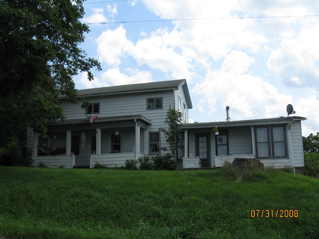
Address: 7185 SHERROD HILL RD
Parcel: 13019055000300
Parcel Profile
Address
7185 | SHERROD HILL | RD
Street Status
PAVED
School District
NORTHWESTERN SCHOOL
Acreage
0.2742
Classification
R
Land Use Code
SINGLE FAMILY
Legal Description
7185 SHERROD HILL RD 125 X 100
Square Feet
2040
Topo
ROLLING
Utility
GAS | WELL | SEPTIC
Zoning
Please contact your municipal zoning officer
Deed Book
0502
Deed Page
0139
2026 Tax Values
Land Value / Taxable
17,400 / 17,400.00
Building Value / Taxable
73,130 / 73,130.00
Total Value / Taxable
90,530 / 90,530.00
Clean & Green
Inactive
Homestead Status
Active
Farmstead Status
Inactive
Lerta Amount
0
Lerta Expiration Year
0
Residential Data
Card 1
Style
OLD STYLE
Basement
PART
Year Built
1860
Exterior Wall
ALUMINUM/VINYL
Total Living Area
2040
Full Baths
1
Half Baths
0
Fuel Type
PROPANE
Heating
CENTRAL
Heating System
FORCED AIR
Stories
2.0
Total Bedrooms
3
Total Family Rooms
0
Total Rooms
8
Fireplaces
0
Other Buildings & Yards
No OBY Data Found
Sales History
Sale Date
Type
Price
Book / Page
Other Info
6/6/1997
0
0502 / 0139
Parcel Sketches
Residential Card 1
A
MAIN
576 square feet
B
EFP ENCL FRAME PORCH
140 square feet
C
UNFIN BSMT BASEMENT UNFINISHED 1S FR ONE STORY FRAME
888 square feet
D
OFP OPEN FRAME PORCH
48 square feet
E
OFP OPEN FRAME PORCH
144 square feet
F
EFP ENCL FRAME PORCH
144 square feet
Parcel Images
Please note:
this tab is for informational purposes only and may not show all delinquencies, see the Taxes tab for more accurate delinquent taxes due.