Elected Officials
Courts
Departments
Initiatives
Open Government
About
Login / Register
Home
/
Property & Tax Records
/
Property Records
/
Property & Tax Search
/
Parcel Profile
/
Print View
Search for Another Parcel
Parcel Profile
Historical Card
Sketches
Photos
Tax Map
Taxes
Print View
Print This Page
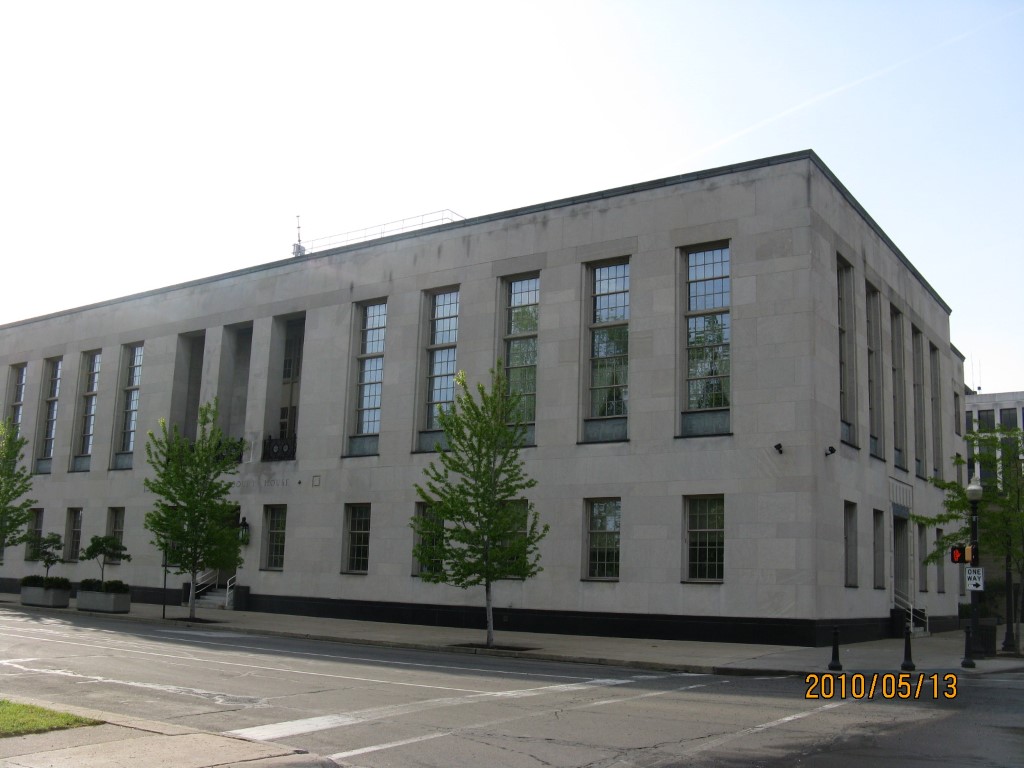
Address: SE CORNER STATE AND S PARK ROW
Parcel: 14010001020400
Parcel Profile
Address
0 | SE | CORNER STATE AND S PARK ROW
Street Status
PAVED | SIDEWALK
School District
CITY OF ERIE SCHOOL
Acreage
0.5941
Classification
E
Land Use Code
EXEMPT FEDERAL GOVERNMENT
Legal Description
SE COR STATE ST IRR
Square Feet
42924
Topo
LEVEL
Utility
ALL PUBLIC
Zoning
Please contact your municipal zoning officer
2026 Tax Values
Land Value / Taxable
258,800 / 258,800.00
Building Value / Taxable
4,611,000 / 4,611,000.00
Total Value / Taxable
4,869,800 / 4,869,800.00
Clean & Green
Inactive
Homestead Status
Inactive
Farmstead Status
Inactive
Lerta Amount
0
Lerta Expiration Year
0
Commercial Data
Card 1
OFFICE BLDG L/R 1-4S
Business Living Area - 42924
Year Built - 1937
Improvement Name - US COURT OFFICE & POST OFFICE
Value - 4604770
Other Buildings & Yards
No OBY Data Found
Sales History
No Sales History Found
Parcel Sketches
Commercial Card 1
A
MAIN
14308 square feet
B
MAIN
14308 square feet
C
MAIN
14308 square feet
D
MAIN
2784 square feet
Parcel Images
Please note:
this tab is for informational purposes only and may not show all delinquencies, see the Taxes tab for more accurate delinquent taxes due.