Elected Officials
Courts
Departments
Initiatives
Open Government
About
Login / Register
Home
/
Property & Tax Records
/
Property Records
/
Property & Tax Search
/
Parcel Profile
/
Print View
Search for Another Parcel
Parcel Profile
Historical Card
Sketches
Photos
Tax Map
Taxes
Print View
Print This Page
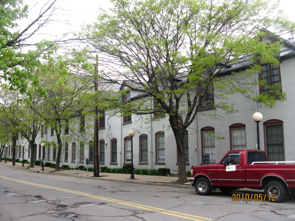
Address: 333 STATE ST
Parcel: 14010003010000
Parcel Profile
Address
333 | STATE | ST
Street Status
PAVED | SIDEWALK
School District
CITY OF ERIE SCHOOL
Acreage
1.6705
Classification
C
Land Use Code
COMMERCIAL COMMON AREA
Legal Description
333 STATE ST 1.6705 AC | MODERN TOOL CONDO
Square Feet
53275
Topo
LEVEL
Utility
ALL PUBLIC
Zoning
Please contact your municipal zoning officer
Deed Book
0260
Deed Page
0442
2026 Tax Values
Land Value / Taxable
0 / 0.00
Building Value / Taxable
0 / 0.00
Total Value / Taxable
0 / 0.00
Clean & Green
Inactive
Homestead Status
Inactive
Farmstead Status
Inactive
Lerta Amount
0
Lerta Expiration Year
0
Commercial Data
Card 1
MIXED RESIDENTIAL/COMMERCIAL
Business Living Area - 53275
Year Built - 1800
Improvement Name - MODERN TOOL CONDOMINUM
Value - 1299270
Other Buildings & Yards
No OBY Data Found
Sales History
Sale Date
Type
Price
Book / Page
Other Info
12/27/1995
0
0260 / 0442
12/30/1991
0
0189 / 1818
12/30/1991
LAND & BUILDING
1900000
0189 / 2052
12/30/1991
0
0189 / 2052
12/16/1991
0
0188 / 1252
4/10/1985
0
1575 / 0269
8/7/1984
0
1547 / 0332
9/29/1982
0
1471 / 0252
4/10/1931
0
0340 / 0602
Parcel Sketches
Commercial Card 1
A
MAIN
53275 square feet
Parcel Images
Please note:
this tab is for informational purposes only and may not show all delinquencies, see the Taxes tab for more accurate delinquent taxes due.