Elected Officials
Courts
Departments
Initiatives
Open Government
About
Login / Register
Home
/
Property & Tax Records
/
Property Records
/
Property & Tax Search
/
Parcel Profile
/
Print View
Search for Another Parcel
Parcel Profile
Historical Card
Sketches
Photos
Tax Map
Taxes
Print View
Print This Page
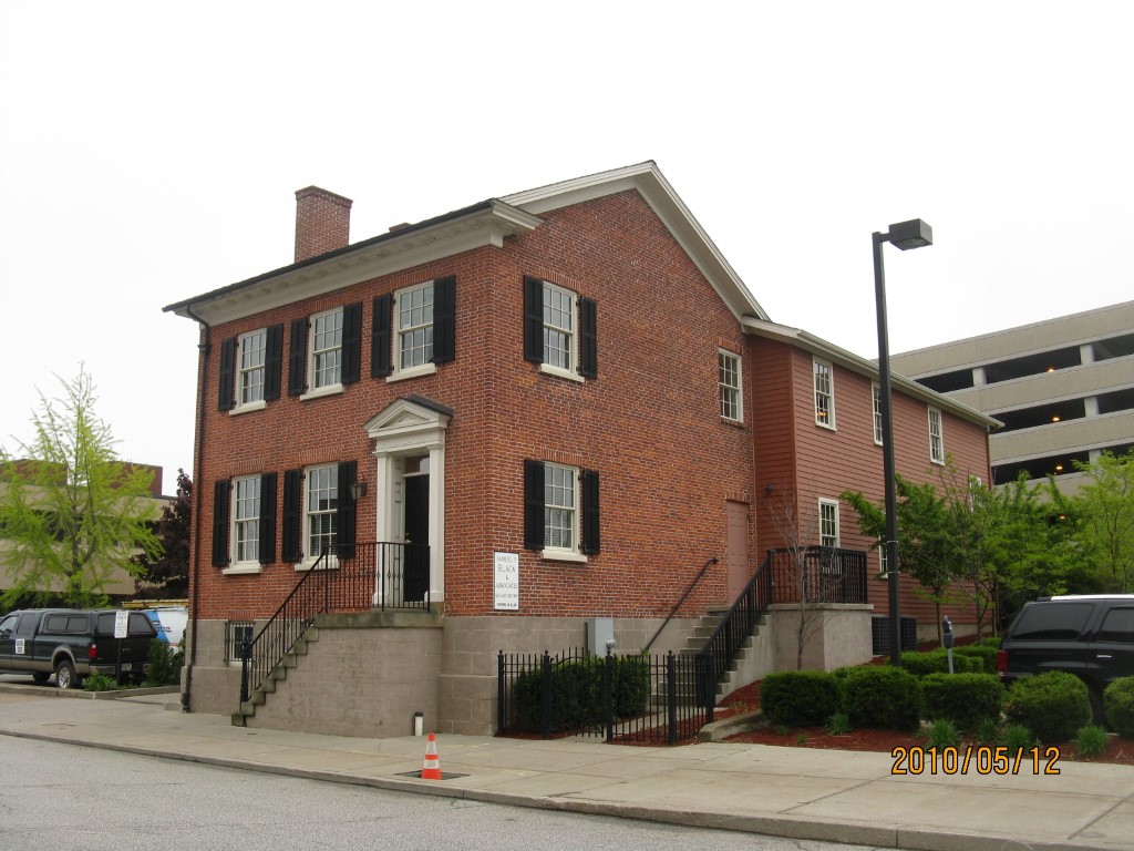
Address: 121 E 2 ST
Parcel: 14010006021200
Parcel Profile
Address
121 | E | 2 | ST
Street Status
PAVED | SIDEWALK
School District
CITY OF ERIE SCHOOL
Acreage
0.1525
Classification
C
Land Use Code
OFFICE BLDGS/LABS/LIBRARIES
Legal Description
121 E 2 ST 40.25 X 165
Square Feet
4232
Topo
LEVEL
Utility
ALL PUBLIC
Zoning
Please contact your municipal zoning officer
Deed Book
0872
Deed Page
2033
2026 Tax Values
Land Value / Taxable
19,900 / 19,900.00
Building Value / Taxable
269,900 / 269,900.00
Total Value / Taxable
289,800 / 289,800.00
Clean & Green
Inactive
Homestead Status
Inactive
Farmstead Status
Inactive
Lerta Amount
0.00
Lerta Expiration Year
2008
Commercial Data
Card 1
RESIDENTIAL 1 FAMILY
Business Living Area - 4232
Year Built - 1867
Improvement Name - SAMUEL P. BLACK & ASSOCIATES
Value - 256660
Other Buildings & Yards
No OBY Data Found
Sales History
Sale Date
Type
Price
Book / Page
Other Info
4/22/2002
0
0872 / 2033
4/22/2002
LAND & BUILDING
3333
872 / 2028
AFFIDAVIT
4/22/2002
LAND & BUILDING
3333
872 / 2026
AFFIDAVIT
4/22/2002
LAND & BUILDING
3333
872 / 2030
AFFIDAVIT
1/11/2002
LAND & BUILDING
3333
843 / 135
9/28/2001
LAND & BUILDING
89900
813 / 203
6/4/1993
0
0272 / 1678
10/21/1944
0
0451 / 0342
10/5/1944
0
0395 / 0014
Parcel Sketches
Commercial Card 1
A
MAIN
2116 square feet
B
MAIN
2116 square feet
C
MAIN
2116 square feet
Parcel Images
Please note:
this tab is for informational purposes only and may not show all delinquencies, see the Taxes tab for more accurate delinquent taxes due.