Elected Officials
Courts
Departments
Initiatives
Open Government
About
Login / Register
Home
/
Property & Tax Records
/
Property Records
/
Property & Tax Search
/
Parcel Profile
/
Print View
Search for Another Parcel
Parcel Profile
Historical Card
Sketches
Photos
Tax Map
Taxes
Print View
Print This Page
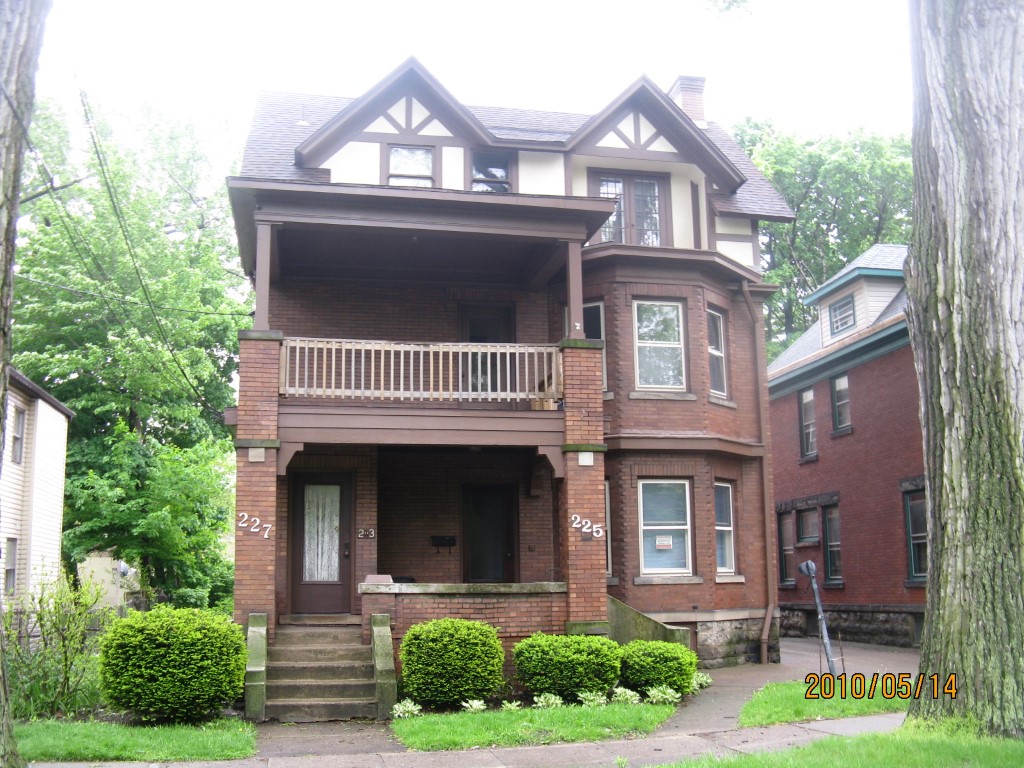
Address: 227 E 6 ST
Parcel: 14010007021500
Parcel Profile
Address
227 | E | 6 | ST
Street Status
PAVED | SIDEWALK
School District
CITY OF ERIE SCHOOL
Acreage
0.2055
Classification
C
Land Use Code
OFFICE BLDGS/LABS/LIBRARIES
Legal Description
227 E 6 ST 54.25 X 165
Square Feet
5672
Topo
LEVEL
Utility
ALL PUBLIC
Zoning
Please contact your municipal zoning officer
Deed Book
0090
Deed Page
2269
2026 Tax Values
Land Value / Taxable
13,400 / 13,400.00
Building Value / Taxable
60,200 / 60,200.00
Total Value / Taxable
73,600 / 73,600.00
Clean & Green
Inactive
Homestead Status
Inactive
Farmstead Status
Inactive
Lerta Amount
0
Lerta Expiration Year
0
Commercial Data
Card 1
MIXED RESIDENTIAL/COMMERCIAL
Business Living Area - 5672
Year Built - 1912
Improvement Name - LAW OFFICE
Value - 101010
Other Buildings & Yards
Description
Built
Width
Length
Area
PAVING ASPHALT PARKING
1995
0
0
1000
Sales History
Sale Date
Type
Price
Book / Page
Other Info
6/29/1989
0
0090 / 2269
2/28/1989
0
0079 / 0199
8/1/1985
0
1590 / 0399
7/20/1963
0
0881 / 0371
2/6/1956
0
0721 / 0165
5/14/1946
0
0480 / 0098
Parcel Sketches
Commercial Card 1
A
MAIN
1424 square feet
B
MAIN
1424 square feet
C
MAIN
1424 square feet
D
MAIN
1400 square feet
Parcel Images
Please note:
this tab is for informational purposes only and may not show all delinquencies, see the Taxes tab for more accurate delinquent taxes due.