Elected Officials
Courts
Departments
Initiatives
Open Government
About
Login / Register
Home
/
Property & Tax Records
/
Property Records
/
Property & Tax Search
/
Parcel Profile
/
Print View
Search for Another Parcel
Parcel Profile
Historical Card
Sketches
Photos
Tax Map
Taxes
Print View
Print This Page
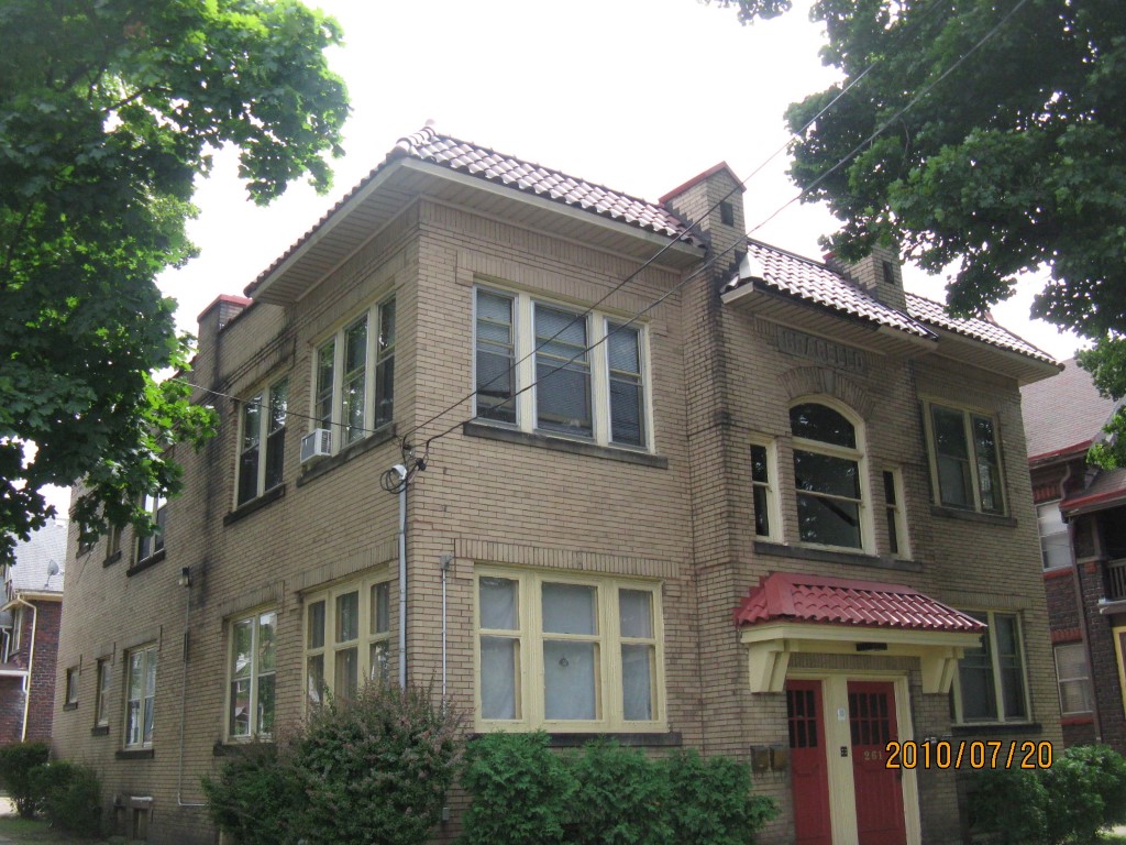
Address: 261 63 E 6 ST
Parcel: 14010007024100
Parcel Profile
Address
261 | 63 | E | 6 | ST
Street Status
PAVED | SIDEWALK
School District
CITY OF ERIE SCHOOL
Acreage
0.0838
Classification
A
Land Use Code
APARTMENTS 4 - 19 UNITS
Legal Description
261 63 E 6 ST 41.25 X IRR
Square Feet
5928
Topo
LEVEL
Utility
ALL PUBLIC
Zoning
Please contact your municipal zoning officer
Deed Book
2024
Deed Page
021035
2026 Tax Values
Land Value / Taxable
16,400 / 16,400.00
Building Value / Taxable
159,160 / 159,160.00
Total Value / Taxable
175,560 / 175,560.00
Clean & Green
Inactive
Homestead Status
Inactive
Farmstead Status
Inactive
Lerta Amount
0
Lerta Expiration Year
0
Commercial Data
Card 1
MIXED RESIDENTIAL/COMMERCIAL
Business Living Area - 5928
Year Built - 1920
Improvement Name - APARTMENTS
Value - 91950
Other Buildings & Yards
Description
Built
Width
Length
Area
PAVING CONCRETE AVERAGE
1920
0
0
1000
Sales History
Sale Date
Type
Price
Book / Page
Other Info
12/23/2024
LAND & BUILDING
330000
2024 / 021035
DEED
2/22/2023
LAND & BUILDING
0
2023 / 002739
QUIT CLAIM DEED
12/6/2001
LAND & BUILDING
0
0832 / 0469
9/11/1995
0
0402 / 1466
4/1/1943
0
0431 / 0129
11/30/1940
0
0403 / 0758
Parcel Sketches
Commercial Card 1
A
MAIN
1872 square feet
B
MAIN
2028 square feet
C
MAIN
2028 square feet
Parcel Images
Please note:
this tab is for informational purposes only and may not show all delinquencies, see the Taxes tab for more accurate delinquent taxes due.