Elected Officials
Courts
Departments
Initiatives
Open Government
About
Login / Register
Home
/
Property & Tax Records
/
Property Records
/
Property & Tax Search
/
Parcel Profile
/
Print View
Search for Another Parcel
Parcel Profile
Historical Card
Sketches
Photos
Tax Map
Taxes
Print View
Print This Page
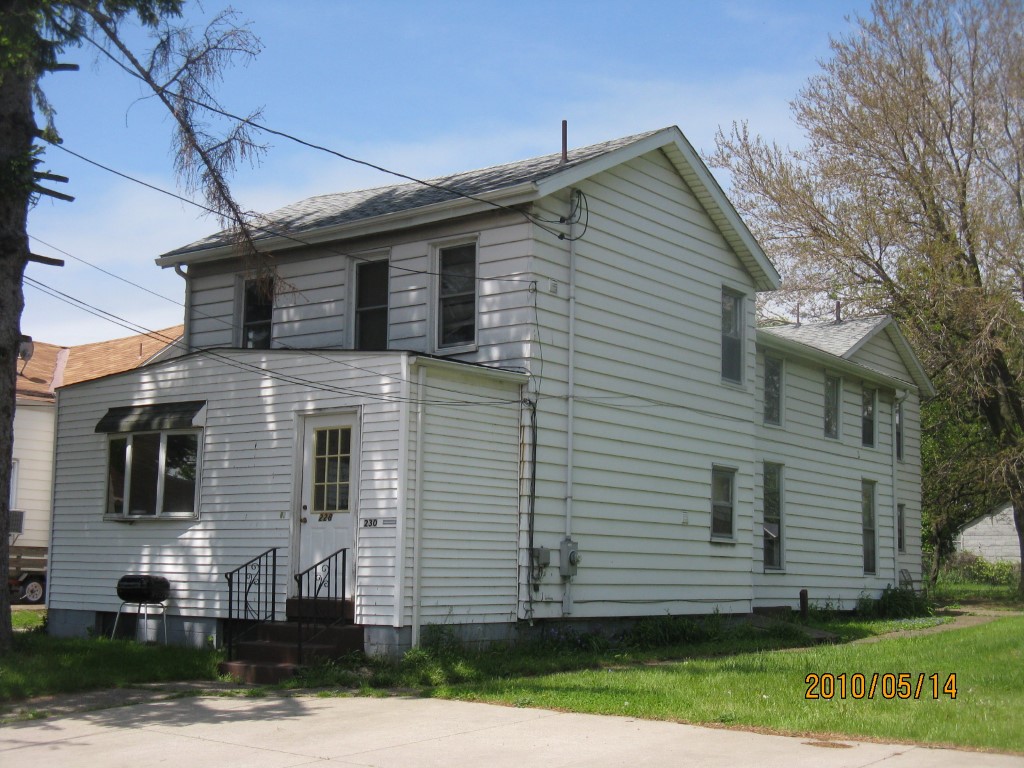
Address: 226 30 E 4 ST
Parcel: 14010009013800
Parcel Profile
Address
226 | 30 | E | 4 | ST
Street Status
PAVED | SIDEWALK
School District
CITY OF ERIE SCHOOL
Acreage
0.3125
Classification
A
Land Use Code
APARTMENTS 4 - 19 UNITS
Legal Description
226 28 30 E 4 ST 82.5 X 165
Square Feet
3816
Topo
LEVEL
Utility
ALL PUBLIC
Zoning
Please contact your municipal zoning officer
Deed Book
0481
Deed Page
0750
2026 Tax Values
Land Value / Taxable
20,400 / 20,400.00
Building Value / Taxable
35,800 / 35,800.00
Total Value / Taxable
56,200 / 56,200.00
Clean & Green
Inactive
Homestead Status
Inactive
Farmstead Status
Inactive
Lerta Amount
0
Lerta Expiration Year
0
Commercial Data
Card 1
RESIDENTIAL 4 FAMILY
Business Living Area - 3816
Year Built - 1872
Improvement Name - APARTMENTS
Value - 44290
Other Buildings & Yards
No OBY Data Found
Sales History
Sale Date
Type
Price
Book / Page
Other Info
1/28/1997
0
0481 / 0750
12/1/1994
0
0364 / 2086
3/21/1989
0
0080 / 2016
8/3/1983
0
1504 / 0117
7/7/1977
0
1270 / 0489
9/30/1946
0
0483 / 0469
3/22/1945
0
0448 / 0295
Parcel Sketches
Commercial Card 1
A
MAIN
1272 square feet
B
MAIN
1272 square feet
C
MAIN
1272 square feet
Parcel Images
Please note:
this tab is for informational purposes only and may not show all delinquencies, see the Taxes tab for more accurate delinquent taxes due.