Elected Officials
Courts
Departments
Initiatives
Open Government
About
Login / Register
Home
/
Property & Tax Records
/
Property Records
/
Property & Tax Search
/
Parcel Profile
/
Print View
Search for Another Parcel
Parcel Profile
Historical Card
Sketches
Photos
Tax Map
Taxes
Print View
Print This Page
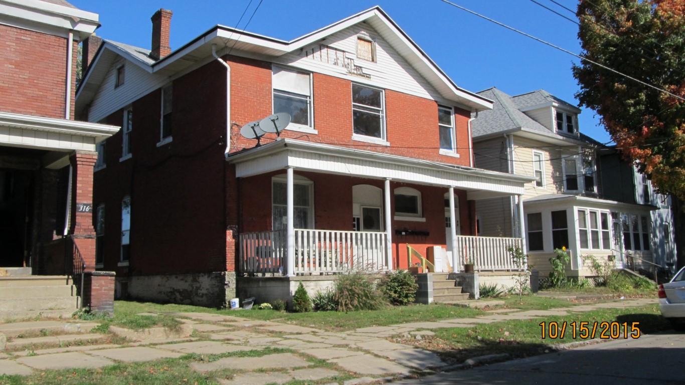
Address: 320 22 E 8 ST
Parcel: 14010010013500
Parcel Profile
Address
320 | 22 | E | 8 | ST
Street Status
PAVED | SIDEWALK
School District
CITY OF ERIE SCHOOL
Acreage
0.1892
Classification
A
Land Use Code
APARTMENTS 4 - 19 UNITS
Legal Description
320 22 E 8 ST 52.5 X 157
Square Feet
6520
Topo
LEVEL
Utility
ALL PUBLIC
Zoning
Please contact your municipal zoning officer
Deed Book
2012
Deed Page
015463
2026 Tax Values
Land Value / Taxable
12,400 / 12,400.00
Building Value / Taxable
25,900 / 25,900.00
Total Value / Taxable
38,300 / 38,300.00
Clean & Green
Inactive
Homestead Status
Inactive
Farmstead Status
Inactive
Lerta Amount
0
Lerta Expiration Year
0
Commercial Data
Card 1
RESIDENTIAL 4 FAMILY
Business Living Area - 6520
Year Built - 1857
Improvement Name - APARTMENTS
Value - 25850
Other Buildings & Yards
No OBY Data Found
Sales History
Sale Date
Type
Price
Book / Page
Other Info
6/13/2012
LAND & BUILDING
12000
2012 / 015463
DEED
8/21/2007
LAND & BUILDING
20000
1440 / 1791
DEED
7/21/2006
LAND & BUILDING
0
1346 / 0667
DEED
11/5/1999
LAND & BUILDING
35000
672 / 984
7/1/1986
0
1636 / 0351
1/31/1985
0
1568 / 0006
5/14/1979
0
1348 / 0245
7/27/1957
0
0759 / 0474
Parcel Sketches
Commercial Card 1
A
MAIN
2360 square feet
B
MAIN
2360 square feet
C
MAIN
1800 square feet
Parcel Images
Please note:
this tab is for informational purposes only and may not show all delinquencies, see the Taxes tab for more accurate delinquent taxes due.