Elected Officials
Courts
Departments
Initiatives
Open Government
About
Login / Register
Home
/
Property & Tax Records
/
Property Records
/
Property & Tax Search
/
Parcel Profile
/
Print View
Search for Another Parcel
Parcel Profile
Historical Card
Sketches
Photos
Tax Map
Taxes
Print View
Print This Page
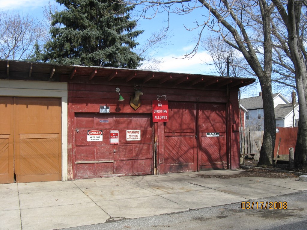
Address: 511 PARADE
Parcel: 14010014013800
Parcel Profile
Address
511 | PARADE
Street Status
ALLEY
School District
CITY OF ERIE SCHOOL
Acreage
0.0188
Classification
R
Land Use Code
OUTBUILDINGS ONLY; NO LIVING UNITS
Legal Description
511 PARADE REAR BL 36 X 22.74
Topo
LEVEL
Utility
ALL PUBLIC
Zoning
Please contact your municipal zoning officer
Deed Book
2015
Deed Page
017478
2026 Tax Values
Land Value / Taxable
400 / 400.00
Building Value / Taxable
1,500 / 1,500.00
Total Value / Taxable
1,900 / 1,900.00
Clean & Green
Inactive
Homestead Status
Inactive
Farmstead Status
Inactive
Lerta Amount
0
Lerta Expiration Year
0
Other Buildings & Yards
Description
Built
Width
Length
Area
FRAME OR CB DETACHED GARAGE
1935
20
22
440
Sales History
Sale Date
Type
Price
Book / Page
Other Info
8/12/2015
LAND & BUILDING
19500
2015 / 017478
SPECIAL WARRANTY DEED
2/15/2011
LAND & BUILDING
1700
2011 / 003979
QUIT CLAIM DEED
12/11/2005
LAND & BUILDING
1500
1210 / 1244
QUIT CLAIM DEED
11/15/1983
0
1516 / 0263
11/15/1983
LAND & BUILDING
0
1516 / 263
AFFIDAVIT
Parcel Sketches
Invalid Parcel Number or No Sketches on File
Parcel Images
Please note:
this tab is for informational purposes only and may not show all delinquencies, see the Taxes tab for more accurate delinquent taxes due.