Elected Officials
Courts
Departments
Initiatives
Open Government
About
Login / Register
Home
/
Property & Tax Records
/
Property Records
/
Property & Tax Search
/
Parcel Profile
/
Print View
Search for Another Parcel
Parcel Profile
Historical Card
Sketches
Photos
Tax Map
Taxes
Print View
Print This Page
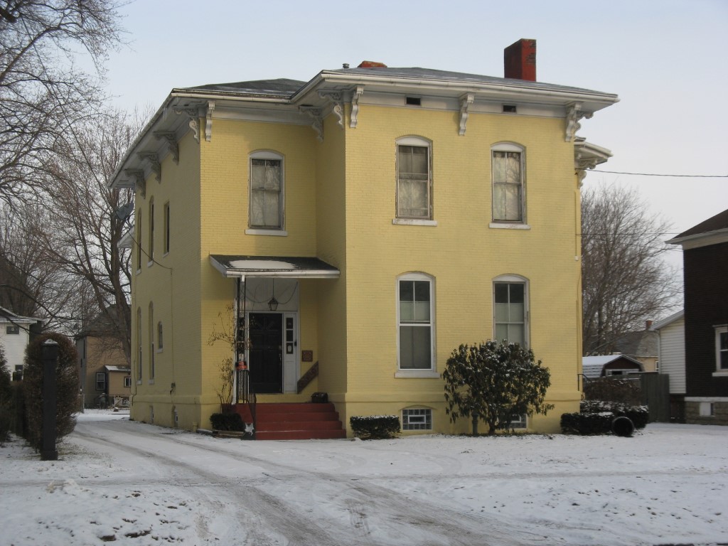
Address: 530 E 6 ST
Parcel: 14010017013000
Parcel Profile
Address
530 | E | 6 | ST
Street Status
PAVED | SIDEWALK
School District
CITY OF ERIE SCHOOL
Acreage
0.3927
Classification
A
Land Use Code
APARTMENTS 4 - 19 UNITS
Legal Description
530 E 6 ST 74.05 X 210 IRR
Square Feet
6318
Topo
LEVEL
Utility
ALL PUBLIC
Zoning
Please contact your municipal zoning officer
Deed Book
2010
Deed Page
001730
2026 Tax Values
Land Value / Taxable
25,700 / 25,700.00
Building Value / Taxable
34,300 / 34,300.00
Total Value / Taxable
60,000 / 60,000.00
Clean & Green
Inactive
Homestead Status
Inactive
Farmstead Status
Inactive
Lerta Amount
0
Lerta Expiration Year
0
Commercial Data
Card 1
RESIDENTIAL 4 FAMILY
Business Living Area - 6318
Year Built - 1872
Improvement Name - APARTMENTS
Value - 89330
Other Buildings & Yards
No OBY Data Found
Sales History
Sale Date
Type
Price
Book / Page
Other Info
1/22/2010
LAND & BUILDING
30000
2010 / 001730
DEED
7/15/2009
LAND & BUILDING
0
1577 / 0278
CORPORATE DEED
10/1/2007
LAND & BUILDING
79900
1450 / 1620
DEED
3/16/1990
0
0115 / 1988
Parcel Sketches
Commercial Card 1
A
MAIN
2106 square feet
B
MAIN
2106 square feet
C
MAIN
2106 square feet
Parcel Images
Please note:
this tab is for informational purposes only and may not show all delinquencies, see the Taxes tab for more accurate delinquent taxes due.