Elected Officials
Courts
Departments
Initiatives
Open Government
About
Login / Register
Home
/
Property & Tax Records
/
Property Records
/
Property & Tax Search
/
Parcel Profile
/
Print View
Search for Another Parcel
Parcel Profile
Historical Card
Sketches
Photos
Tax Map
Taxes
Print View
Print This Page
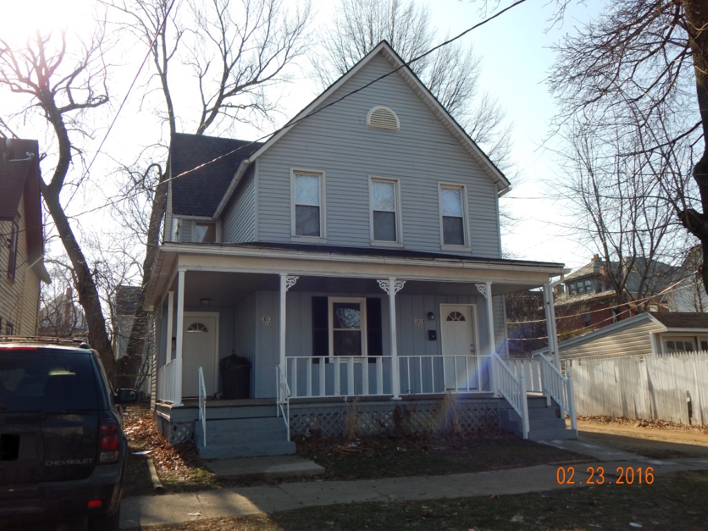
Address: 1013 E 5 ST
Parcel: 14010036011500
Parcel Profile
Address
1013 | E | 5 | ST
Street Status
PAVED | ALLEY
School District
CITY OF ERIE SCHOOL
Acreage
0.0772
Classification
R
Land Use Code
TWO FAMILY
Legal Description
1013 E 5 ST 31 X IRR
Square Feet
2104
Topo
LEVEL
Utility
ALL PUBLIC
Zoning
Please contact your municipal zoning officer
Deed Book
2024
Deed Page
006569
2026 Tax Values
Land Value / Taxable
8,000 / 8,000.00
Building Value / Taxable
43,164 / 43,164.00
Total Value / Taxable
51,164 / 51,164.00
Clean & Green
Inactive
Homestead Status
Inactive
Farmstead Status
Inactive
Lerta Amount
0
Lerta Expiration Year
0
Residential Data
Card 1
Style
OLD STYLE
Basement
FULL
Year Built
1896
Exterior Wall
ALUMINUM/VINYL
Total Living Area
2104
Full Baths
2
Half Baths
0
Fuel Type
GAS
Heating
CENTRAL
Heating System
FORCED AIR
Stories
2.0
Total Bedrooms
4
Total Family Rooms
0
Total Rooms
9
Fireplaces
0
Other Buildings & Yards
No OBY Data Found
Sales History
Sale Date
Type
Price
Book / Page
Other Info
5/2/2024
LAND & BUILDING
450000
2024 / 006569
SPECIAL WARRANTY DEED
2/2/2016
LAND & BUILDING
40000
2016 / 002305
SPECIAL WARRANTY DEED
5/15/2015
LAND & BUILDING
0
2015 / 009676
QUIT CLAIM DEED
2/27/2015
LAND & BUILDING
2462
2015 / 003525
SHERIFF'S DED
10/19/2005
LAND & BUILDING
13500
1279 / 2148
WARRANTY/SURVIVORSHIP DEED
3/3/2005
LAND & BUILDING
0
1214 / 1876
SHERIFF'S DED
1/23/1998
0
0539 / 1030
1/24/1975
2000
1135 / 0530
9/11/1970
14500
1029 / 0579
7/11/1969
0
1006 / 0150
8/16/1949
0
0545 / 0325
12/3/1946
0
0491 / 0096
Parcel Sketches
Residential Card 1
A
MAIN
952 square feet
B
EFP ENCL FRAME PORCH
24 square feet
C
1S FR ONE STORY FRAME
200 square feet
D
OFP OPEN FRAME PORCH
260 square feet
Parcel Images
Please note:
this tab is for informational purposes only and may not show all delinquencies, see the Taxes tab for more accurate delinquent taxes due.