Elected Officials
Courts
Departments
Initiatives
Open Government
About
Login / Register
Home
/
Property & Tax Records
/
Property Records
/
Property & Tax Search
/
Parcel Profile
/
Print View
Search for Another Parcel
Parcel Profile
Historical Card
Sketches
Photos
Tax Map
Taxes
Print View
Print This Page
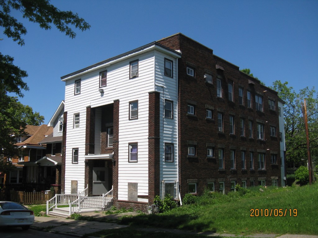
Address: 509 DUNN BLVD
Parcel: 14010040043900
Parcel Profile
Address
509 | DUNN | BLVD
Street Status
PAVED | SIDEWALK
School District
CITY OF ERIE SCHOOL
Acreage
0.0859
Classification
A
Land Use Code
APARTMENTS 4 - 19 UNITS
Legal Description
509 DUNN BLVD 40 X 93.5
Square Feet
10381
Topo
LEVEL
Utility
ALL PUBLIC
Zoning
Please contact your municipal zoning officer
Deed Book
2021
Deed Page
014028
2026 Tax Values
Land Value / Taxable
10,000 / 10,000.00
Building Value / Taxable
220,800 / 220,800.00
Total Value / Taxable
230,800 / 230,800.00
Clean & Green
Inactive
Homestead Status
Inactive
Farmstead Status
Inactive
Lerta Amount
0.00
Lerta Expiration Year
2014
Commercial Data
Card 1
APARTMENTS - GARDEN
Business Living Area - 10381
Year Built - 1922
Improvement Name - APARTMENTS
Value - 220810
Other Buildings & Yards
No OBY Data Found
Sales History
Sale Date
Type
Price
Book / Page
Other Info
6/3/2021
LAND & BUILDING
0
2021 / 014028
SPECIAL WARRANTY DEED
3/28/2014
LAND & BUILDING
320000
2014 / 005768
DEED
2/13/2014
LAND & BUILDING
30701
2014 / 002778
SHERIFF'S DED
4/15/2008
LAND & BUILDING
59000
1488 / 0793
DEED
8/5/2004
LAND & BUILDING
95000
1161 / 0392
DEED
2/3/2000
LAND & BUILDING
0
686 / 778
4/30/1992
0
0209 / 0961
3/30/1983
0
1489 / 0500
1/30/1976
0
1195 / 0284
3/31/1975
0
1143 / 0149
3/30/1970
0
1019 / 0643
2/17/1967
0
0955 / 0594
11/17/1964
0
0907 / 0121
2/7/1961
0
0830 / 0306
12/7/1959
0
0346 / 0162
10/14/1959
0
0809 / 0546
Parcel Sketches
Commercial Card 1
A
MAIN
2253 square feet
B
MAIN
2696 square feet
C
MAIN
2736 square feet
D
MAIN
2696 square feet
Parcel Images
Please note:
this tab is for informational purposes only and may not show all delinquencies, see the Taxes tab for more accurate delinquent taxes due.