Elected Officials
Courts
Departments
Initiatives
Open Government
About
Login / Register
Home
/
Property & Tax Records
/
Property Records
/
Property & Tax Search
/
Parcel Profile
/
Print View
Search for Another Parcel
Parcel Profile
Historical Card
Sketches
Photos
Tax Map
Taxes
Print View
Print This Page
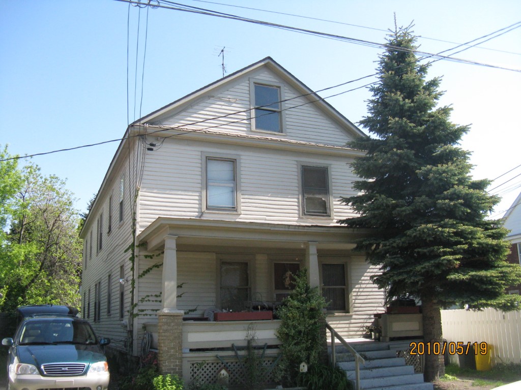
Address: 1211 E 7 ST
Parcel: 14010042010600
Parcel Profile
Address
1211 | E | 7 | ST
Street Status
PAVED | SIDEWALK
School District
CITY OF ERIE SCHOOL
Acreage
0.1267
Classification
A
Land Use Code
APARTMENTS 4 - 19 UNITS
Legal Description
1211 E 7 ST 45.87 X 120
Square Feet
4176
Topo
LEVEL
Utility
ALL PUBLIC
Zoning
Please contact your municipal zoning officer
Deed Book
1074
Deed Page
0672
2026 Tax Values
Land Value / Taxable
8,300 / 8,300.00
Building Value / Taxable
42,600 / 42,600.00
Total Value / Taxable
50,900 / 50,900.00
Clean & Green
Inactive
Homestead Status
Inactive
Farmstead Status
Inactive
Lerta Amount
0
Lerta Expiration Year
0
Commercial Data
Card 1
RESIDENTIAL 4 FAMILY
Business Living Area - 4176
Year Built - 1922
Improvement Name - APARTMENTS
Value - 60470
Other Buildings & Yards
No OBY Data Found
Sales History
Sale Date
Type
Price
Book / Page
Other Info
7/31/1972
0
1074 / 0672
2/27/1969
0
0997 / 0421
6/19/1968
0
0994 / 0598
1/22/1965
0
0909 / 0595
3/13/1964
0
0892 / 0147
8/15/1942
0
0426 / 0151
Parcel Sketches
Commercial Card 1
A
MAIN
1392 square feet
B
MAIN
1392 square feet
C
MAIN
1392 square feet
D
MAIN
696 square feet
Parcel Images
Please note:
this tab is for informational purposes only and may not show all delinquencies, see the Taxes tab for more accurate delinquent taxes due.