Elected Officials
Courts
Departments
Initiatives
Open Government
About
Login / Register
Home
/
Property & Tax Records
/
Property Records
/
Property & Tax Search
/
Parcel Profile
/
Print View
Search for Another Parcel
Parcel Profile
Historical Card
Sketches
Photos
Tax Map
Taxes
Print View
Print This Page
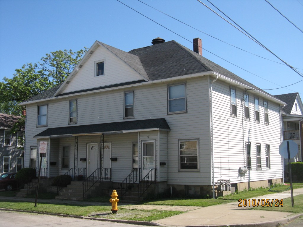
Address: 717 23 PAYNE AVE
Parcel: 14011004011800
Parcel Profile
Address
717 | 23 | PAYNE | AVE
Street Status
PAVED
School District
CITY OF ERIE SCHOOL
Acreage
0.1102
Classification
A
Land Use Code
APARTMENTS 4 - 19 UNITS
Legal Description
717 19 21 23 PAYNE AVE
Square Feet
5424
Topo
LEVEL
Utility
ALL PUBLIC
Zoning
Please contact your municipal zoning officer
Deed Book
1026
Deed Page
0924
2026 Tax Values
Land Value / Taxable
7,200 / 7,200.00
Building Value / Taxable
86,100 / 86,100.00
Total Value / Taxable
93,300 / 93,300.00
Clean & Green
Inactive
Homestead Status
Inactive
Farmstead Status
Inactive
Lerta Amount
0
Lerta Expiration Year
0
Commercial Data
Card 1
RESIDENTIAL 4 FAMILY
Business Living Area - 5424
Year Built - 1913
Improvement Name - APARTMENTS
Value - 78310
Other Buildings & Yards
No OBY Data Found
Sales History
Sale Date
Type
Price
Book / Page
Other Info
6/23/2003
LAND & BUILDING
90000
1026 / 0924
WARRANTY/SURVIVORSHIP DEED
4/5/1995
0
0378 / 1118
6/30/1994
53000
0342 / 2047
10/23/1967
8000
0966 / 0119
4/24/1945
0
0455 / 0062
Parcel Sketches
Commercial Card 1
A
MAIN
1800 square feet
B
MAIN
1824 square feet
C
MAIN
1800 square feet
Parcel Images
Please note:
this tab is for informational purposes only and may not show all delinquencies, see the Taxes tab for more accurate delinquent taxes due.