Elected Officials
Courts
Departments
Initiatives
Open Government
About
Login / Register
Home
/
Property & Tax Records
/
Property Records
/
Property & Tax Search
/
Parcel Profile
/
Print View
Search for Another Parcel
Parcel Profile
Historical Card
Sketches
Photos
Tax Map
Taxes
Print View
Print This Page
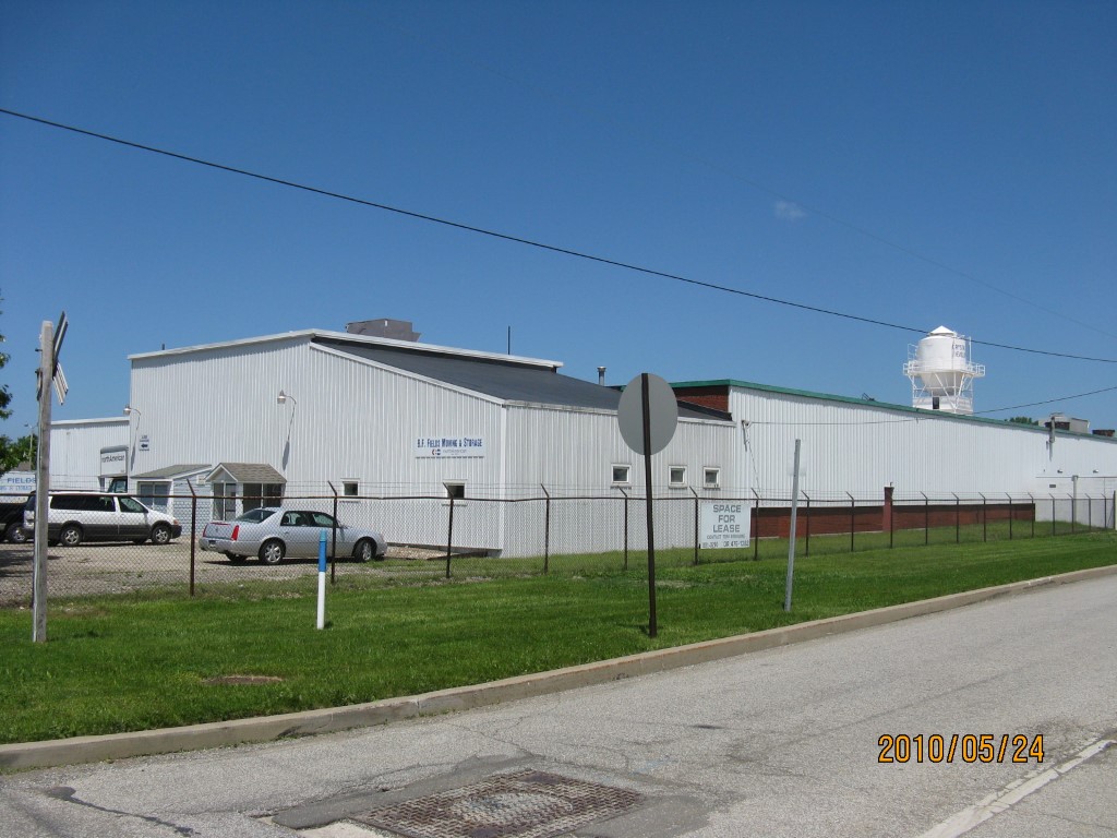
Address: 1840 E 10 ST
Parcel: 14011009010000
Parcel Profile
Address
1840 | E | 10 | ST
Street Status
PAVED | SIDEWALK
School District
CITY OF ERIE SCHOOL
Acreage
9.5366
Classification
I
Land Use Code
LIGHT INDUSTRIAL
Legal Description
1840 E 10 ST 9.5366 AC NET
Square Feet
175772
Topo
LEVEL
Utility
ALL PUBLIC
Zoning
Please contact your municipal zoning officer
Deed Book
2021
Deed Page
034322
2026 Tax Values
Land Value / Taxable
228,400 / 228,400.00
Building Value / Taxable
1,106,400 / 1,106,400.00
Total Value / Taxable
1,334,800 / 1,334,800.00
Clean & Green
Inactive
Homestead Status
Inactive
Farmstead Status
Inactive
Lerta Amount
0.00
Lerta Expiration Year
2016
Commercial Data
Card 1
MFG/PROCESSING
Business Living Area - 172064
Year Built - 1935
Improvement Name - SCOTT'S ELECTRIC/BF FIELDS MOV
Value - 1779480
Card 2
WAREHOUSE
Business Living Area - 3708
Year Built - 1950
Improvement Name - PYRAMID INDUSTRIES
Value - 41920
Other Buildings & Yards
Description
Built
Width
Length
Area
FRAME UTILITY SHED
1935
16
18
288
FENCE CHAIN LINK
1943
6
2115
12690
FRAME UTILITY SHED
1935
10
10
100
Sales History
Sale Date
Type
Price
Book / Page
Other Info
12/30/2021
LAND & BUILDING
0
2021 / 034322
SPECIAL WARRANTY DEED
9/29/1998
0
0590 / 1149
Parcel Sketches
Commercial Card 1
A
MAIN
76532 square feet
B
MAIN
8520 square feet
C
MAIN
8692 square feet
D
MAIN
46008 square feet
E
MAIN
560 square feet
F
MAIN
2952 square feet
G
MAIN
28800 square feet
Commercial Card 2
A
MAIN
3708 square feet
Parcel Images
Please note:
this tab is for informational purposes only and may not show all delinquencies, see the Taxes tab for more accurate delinquent taxes due.