Elected Officials
Courts
Departments
Initiatives
Open Government
About
Login / Register
Home
/
Property & Tax Records
/
Property Records
/
Property & Tax Search
/
Parcel Profile
/
Print View
Search for Another Parcel
Parcel Profile
Historical Card
Sketches
Photos
Tax Map
Taxes
Print View
Print This Page
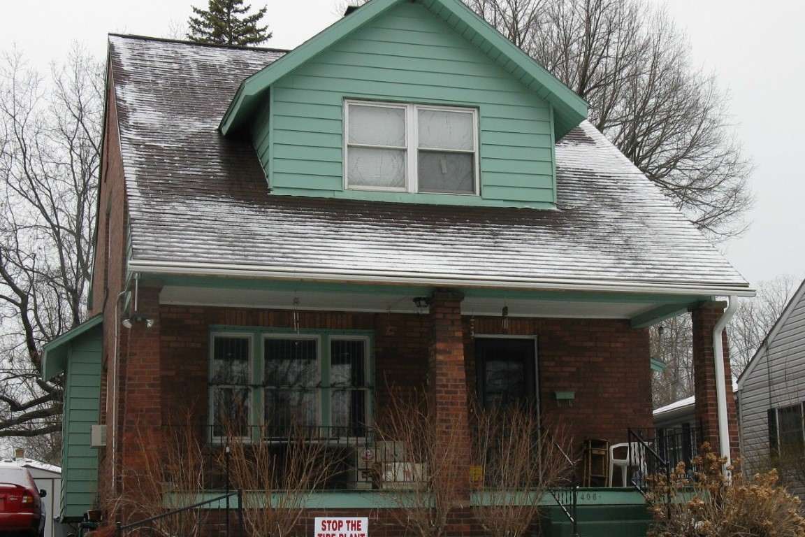
Address: 406 ANDREWS PARK BLVD
Parcel: 14011011020900
Parcel Profile
Address
406 | ANDREWS PARK | BLVD
Street Status
PAVED | SIDEWALK
School District
CITY OF ERIE SCHOOL
Acreage
0.1714
Classification
R
Land Use Code
SINGLE FAMILY
Legal Description
406 ANDREWS PARK BLVD 45X165.9
Square Feet
1930
Topo
LEVEL
Utility
ALL PUBLIC
Zoning
Please contact your municipal zoning officer
Deed Book
2021
Deed Page
013519
2026 Tax Values
Land Value / Taxable
14,000 / 14,000.00
Building Value / Taxable
59,870 / 59,870.00
Total Value / Taxable
73,870 / 73,870.00
Clean & Green
Inactive
Homestead Status
Inactive
Farmstead Status
Inactive
Lerta Amount
0
Lerta Expiration Year
0
Residential Data
Card 1
Style
OLD STYLE
Basement
FULL
Year Built
1917
Exterior Wall
BRICK
Total Living Area
1930
Full Baths
1
Half Baths
1
Fuel Type
ELECTRIC
Heating
CENTRAL
Heating System
ELECTRIC
Stories
2.0
Total Bedrooms
3
Total Family Rooms
0
Total Rooms
7
Fireplaces
1
Other Buildings & Yards
No OBY Data Found
Sales History
Sale Date
Type
Price
Book / Page
Other Info
5/28/2021
LAND & BUILDING
15352
2021 / 013519
SPECIAL WARRANTY DEED
6/23/1987
0
0016 / 1178
Parcel Sketches
Residential Card 1
A
MAIN
832 square feet
B
OMP OPEN MASONRY PORCH
208 square feet
C
FRBAY FRAME BAY
24 square feet
D
1S FR ONE STORY FRAME
242 square feet
E
OMP OPEN MASONRY PORCH
28 square feet
Parcel Images
Please note:
this tab is for informational purposes only and may not show all delinquencies, see the Taxes tab for more accurate delinquent taxes due.