Elected Officials
Courts
Departments
Initiatives
Open Government
About
Login / Register
Home
/
Property & Tax Records
/
Property Records
/
Property & Tax Search
/
Parcel Profile
/
Print View
Search for Another Parcel
Parcel Profile
Historical Card
Sketches
Photos
Tax Map
Taxes
Print View
Print This Page
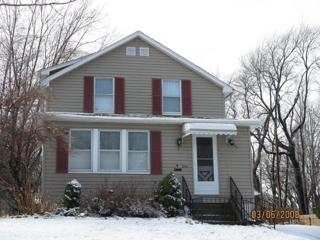
Address: 226 ANDREWS PARK BLVD
Parcel: 14011012020400
Parcel Profile
Address
226 | ANDREWS PARK | BLVD
Street Status
PAVED | SIDEWALK
School District
CITY OF ERIE SCHOOL
Acreage
0.2849
Classification
R
Land Use Code
SINGLE FAMILY
Legal Description
226 ANDREWS PARK BLVD 101.04 X 131.32 IRREG
Square Feet
1376
Topo
LEVEL
Utility
ALL PUBLIC
Zoning
Please contact your municipal zoning officer
Deed Book
2019
Deed Page
022584
2026 Tax Values
Land Value / Taxable
15,300 / 15,300.00
Building Value / Taxable
65,630 / 65,630.00
Total Value / Taxable
80,930 / 80,930.00
Clean & Green
Inactive
Homestead Status
Active
Farmstead Status
Inactive
Lerta Amount
0
Lerta Expiration Year
0
Residential Data
Card 1
Style
OLD STYLE
Basement
FULL
Year Built
1929
Exterior Wall
ALUMINUM/VINYL
Total Living Area
1376
Full Baths
1
Half Baths
0
Fuel Type
GAS
Heating
CENTRAL A/C
Heating System
FORCED AIR
Stories
2.0
Total Bedrooms
3
Total Family Rooms
0
Total Rooms
6
Fireplaces
1
Other Buildings & Yards
Description
Built
Width
Length
Area
FRAME OR CB DETACHED GARAGE
1950
24
28
672
Sales History
Sale Date
Type
Price
Book / Page
Other Info
11/4/2019
LAND & BUILDING
117900
2019 / 022584
SPECIAL WARRANTY DEED
12/15/2017
LAND & BUILDING
86500
2017 / 027260
DEED
10/23/1997
0
0525 / 0783
10/4/1955
0
0713 / 0266
4/22/1950
0
0562 / 0184
7/29/1948
0
0520 / 0111
3/20/1942
0
0418 / 0476
6/23/1936
0
0393 / 0210
Parcel Sketches
Residential Card 1
A
MAIN
660 square feet
B
1S FR ONE STORY FRAME
56 square feet
C
UNFIN BSMT BASEMENT UNFINISHED EFP ENCL FRAME PORCH
198 square feet
Parcel Images
Please note:
this tab is for informational purposes only and may not show all delinquencies, see the Taxes tab for more accurate delinquent taxes due.