Elected Officials
Courts
Departments
Initiatives
Open Government
About
Login / Register
Home
/
Property & Tax Records
/
Property Records
/
Property & Tax Search
/
Parcel Profile
/
Print View
Search for Another Parcel
Parcel Profile
Historical Card
Sketches
Photos
Tax Map
Taxes
Print View
Print This Page
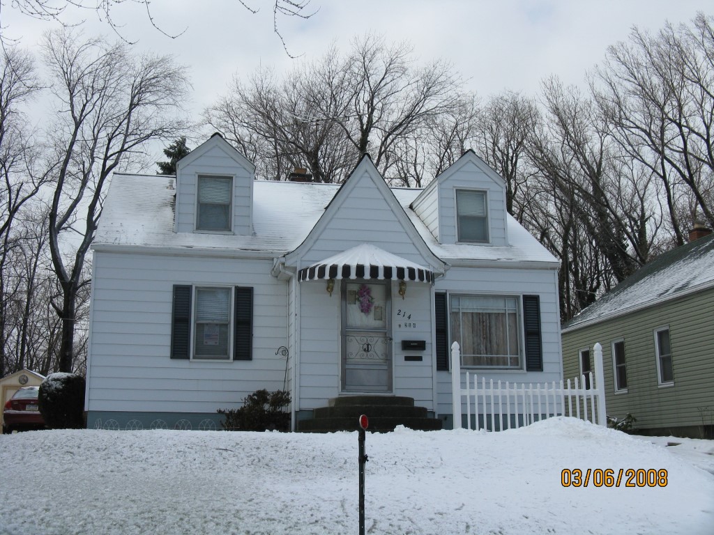
Address: 214 ANDREWS PARK BLVD
Parcel: 14011012020700
Parcel Profile
Address
214 | ANDREWS PARK | BLVD
Street Status
PAVED | SIDEWALK
School District
CITY OF ERIE SCHOOL
Acreage
0.1256
Classification
R
Land Use Code
SINGLE FAMILY
Legal Description
214 ANDREWS PARK BLVD 42.25 X IRR
Square Feet
1092
Topo
LEVEL
Utility
ALL PUBLIC
Zoning
Please contact your municipal zoning officer
Deed Book
2026
Deed Page
010892
2026 Tax Values
Land Value / Taxable
13,400 / 13,400.00
Building Value / Taxable
54,690 / 54,690.00
Total Value / Taxable
68,090 / 68,090.00
Clean & Green
Inactive
Homestead Status
Active
Farmstead Status
Inactive
Lerta Amount
0
Lerta Expiration Year
0
Residential Data
Card 1
Style
CAPE
Basement
FULL
Year Built
1953
Exterior Wall
ALUMINUM/VINYL
Total Living Area
1092
Full Baths
1
Half Baths
0
Fuel Type
GAS
Heating
CENTRAL A/C
Heating System
FORCED AIR
Stories
1.0
Total Bedrooms
3
Total Family Rooms
0
Total Rooms
5
Fireplaces
0
Other Buildings & Yards
No OBY Data Found
Sales History
Sale Date
Type
Price
Book / Page
Other Info
6/24/2026
LAND & BUILDING
161400
2026 / 010892
SPECIAL WARRANTY DEED
8/10/2015
LAND & BUILDING
69148
2015 / 017358
DEED
1/9/1953
0
0643 / 0054
9/12/1951
0
0605 / 0318
Parcel Sketches
Residential Card 1
A
MAIN
780 square feet
B
EFP ENCL FRAME PORCH
72 square feet
C
MA STOOP/TERR MAS STOOP
80 square feet
D
EFP ENCL FRAME PORCH
32 square feet
E
MA STOOP/TERR MAS STOOP
25 square feet
Parcel Images
Please note:
this tab is for informational purposes only and may not show all delinquencies, see the Taxes tab for more accurate delinquent taxes due.