Elected Officials
Courts
Departments
Initiatives
Open Government
About
Login / Register
Home
/
Property & Tax Records
/
Property Records
/
Property & Tax Search
/
Parcel Profile
/
Print View
Search for Another Parcel
Parcel Profile
Historical Card
Sketches
Photos
Tax Map
Taxes
Print View
Print This Page
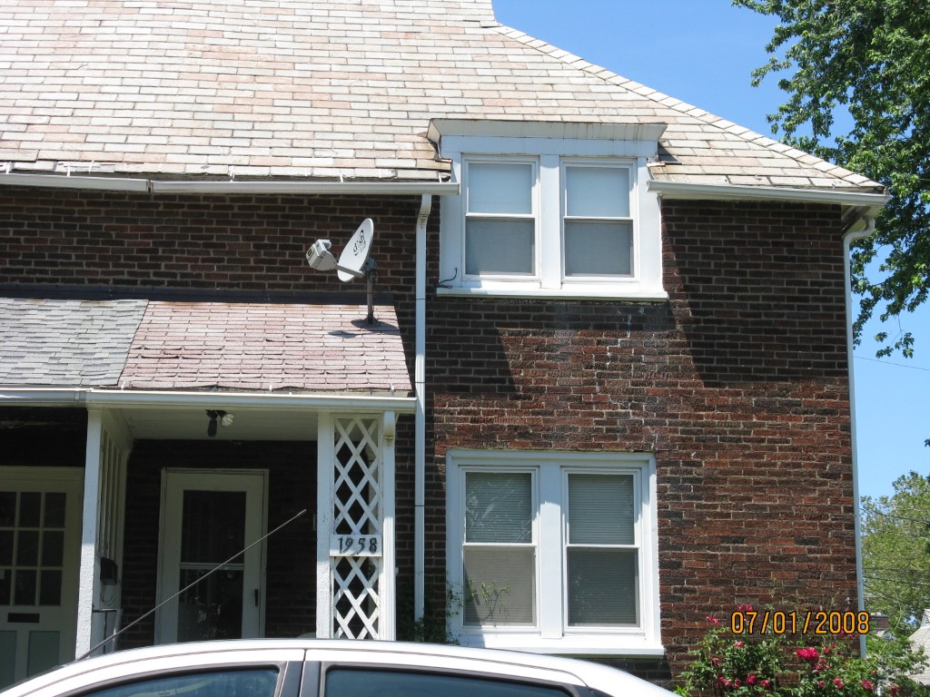
Address: 1958 E 7 ST
Parcel: 14011016023400
Parcel Profile
Address
1958 | E | 7 | ST
Street Status
PAVED | ALLEY
School District
CITY OF ERIE SCHOOL
Acreage
0.0871
Classification
R
Land Use Code
SINGLE FAMILY
Legal Description
1958 E 7 ST 34.5 X 110
Square Feet
1080
Topo
LEVEL
Utility
ALL PUBLIC
Zoning
Please contact your municipal zoning officer
Deed Book
2024
Deed Page
006420
2026 Tax Values
Land Value / Taxable
12,300 / 12,300.00
Building Value / Taxable
37,100 / 37,100.00
Total Value / Taxable
49,400 / 49,400.00
Clean & Green
Inactive
Homestead Status
Inactive
Farmstead Status
Inactive
Lerta Amount
0
Lerta Expiration Year
0
Residential Data
Card 1
Style
ROW
Basement
FULL
Year Built
1918
Exterior Wall
BRICK
Total Living Area
1080
Full Baths
1
Half Baths
0
Fuel Type
GAS
Heating
CENTRAL
Heating System
FORCED AIR
Stories
2.0
Total Bedrooms
2
Total Family Rooms
0
Total Rooms
5
Fireplaces
0
Other Buildings & Yards
No OBY Data Found
Sales History
Sale Date
Type
Price
Book / Page
Other Info
4/30/2024
LAND & BUILDING
65000
2024 / 006420
SPECIAL WARRANTY DEED
9/30/2019
LAND & BUILDING
9000
2019 / 019732
DEED
7/30/2018
LAND & BUILDING
1737
2018 / 015224
SHERIFF'S DED
9/15/2008
LAND & BUILDING
0
1520 / 1370
SPECIAL WARRANTY DEED
5/26/2004
LAND & BUILDING
0
1139 / 0452
FIDUCIARY DEED
12/4/1969
0
1014 / 0490
Parcel Sketches
Residential Card 1
A
MAIN
540 square feet
B
EFP ENCL FRAME PORCH
30 square feet
C
OFP OPEN FRAME PORCH
49 square feet
Parcel Images
Please note:
this tab is for informational purposes only and may not show all delinquencies, see the Taxes tab for more accurate delinquent taxes due.