Elected Officials
Courts
Departments
Initiatives
Open Government
About
Login / Register
Home
/
Property & Tax Records
/
Property Records
/
Property & Tax Search
/
Parcel Profile
/
Print View
Search for Another Parcel
Parcel Profile
Historical Card
Sketches
Photos
Tax Map
Taxes
Print View
Print This Page
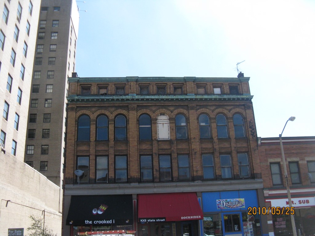
Address: 1013 STATE ST
Parcel: 15020002020600
Parcel Profile
Address
1013 | STATE | ST
Street Status
PAVED | SIDEWALK
School District
CITY OF ERIE SCHOOL
Acreage
0.1010
Classification
C
Land Use Code
RESTAURANTS, STORES (RETAIL)
Legal Description
1013 STATE ST 27.5X160
Square Feet
4240
Topo
LEVEL
Utility
ALL PUBLIC
Zoning
Please contact your municipal zoning officer
Deed Book
2014
Deed Page
011839
2026 Tax Values
Land Value / Taxable
35,200 / 35,200.00
Building Value / Taxable
150,800 / 150,800.00
Total Value / Taxable
186,000 / 186,000.00
Clean & Green
Inactive
Homestead Status
Inactive
Farmstead Status
Inactive
Lerta Amount
0
Lerta Expiration Year
0
Commercial Data
Card 1
DOWNTOWN ROW TYPE
Business Living Area - 4240
Year Built - 1888
Improvement Name - NICKY'S PUB
Value - 237100
Other Buildings & Yards
No OBY Data Found
Sales History
Sale Date
Type
Price
Book / Page
Other Info
6/16/2014
LAND & BUILDING
175000
2014 / 011839
SPECIAL WARRANTY DEED
2/22/2010
LAND & BUILDING
150000
2010 / 003832
SPECIAL WARRANTY DEED
3/10/2006
LAND & BUILDING
75000
1311 / 2312
DEED
7/26/2004
LAND & BUILDING
82500
1157 / 1501
WARRANTY/SURVIVORSHIP DEED
12/29/1997
0
0536 / 0001
1/11/1994
130000
0314 / 0332
2/28/1992
10000
0197 / 1374
1/8/1987
0
1665 / 0118
10/13/1953
0
0662 / 0200
2/4/1946
0
0471 / 0135
Parcel Sketches
Commercial Card 1
A
MAIN
4300 square feet
B
MAIN
4240 square feet
C
MAIN
3438 square feet
D
MAIN
1971 square feet
Parcel Images
Please note:
this tab is for informational purposes only and may not show all delinquencies, see the Taxes tab for more accurate delinquent taxes due.