Elected Officials
Courts
Departments
Initiatives
Open Government
About
Login / Register
Home
/
Property & Tax Records
/
Property Records
/
Property & Tax Search
/
Parcel Profile
/
Print View
Search for Another Parcel
Parcel Profile
Historical Card
Sketches
Photos
Tax Map
Taxes
Print View
Print This Page
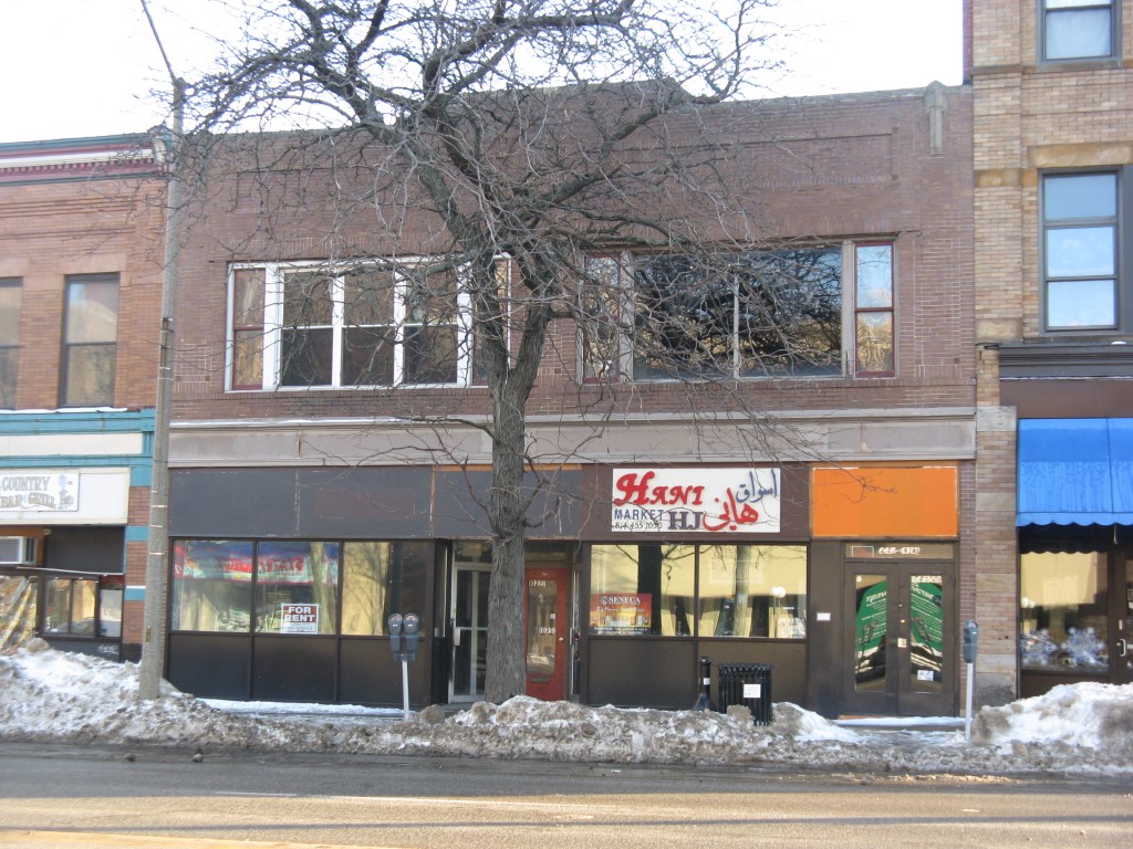
Address: 1025 29 STATE ST
Parcel: 15020002021100
Parcel Profile
Address
1025 | 29 | STATE | ST
Street Status
PAVED
School District
CITY OF ERIE SCHOOL
Acreage
0.1515
Classification
C
Land Use Code
RESTAURANTS, STORES (RETAIL)
Legal Description
1025 29 STATE 41.5X160
Square Feet
6724
Topo
LEVEL
Utility
ALL PUBLIC
Zoning
Please contact your municipal zoning officer
Deed Book
2019
Deed Page
021022
2026 Tax Values
Land Value / Taxable
52,800 / 52,800.00
Building Value / Taxable
57,200 / 57,200.00
Total Value / Taxable
110,000 / 110,000.00
Clean & Green
Inactive
Homestead Status
Inactive
Farmstead Status
Inactive
Lerta Amount
0
Lerta Expiration Year
0
Commercial Data
Card 1
DOWNTOWN ROW TYPE
Business Living Area - 6724
Year Built - 1913
Improvement Name - BLANKS BEAUTY SUPPLY/CYBER CAF
Value - 101570
Other Buildings & Yards
No OBY Data Found
Sales History
Sale Date
Type
Price
Book / Page
Other Info
10/14/2019
LAND & BUILDING
122100
2019 / 021022
FIDUCIARY DEED
5/23/1978
0
1305 / 0571
4/27/1967
0
0959 / 0439
5/29/1944
0
0449 / 0251
4/29/1935
0
0362 / 0493
Parcel Sketches
Commercial Card 1
A
MAIN
4264 square feet
B
MAIN
4264 square feet
C
MAIN
2460 square feet
Parcel Images
Please note:
this tab is for informational purposes only and may not show all delinquencies, see the Taxes tab for more accurate delinquent taxes due.