Elected Officials
Courts
Departments
Initiatives
Open Government
About
Login / Register
Home
/
Property & Tax Records
/
Property Records
/
Property & Tax Search
/
Parcel Profile
/
Print View
Search for Another Parcel
Parcel Profile
Historical Card
Sketches
Photos
Tax Map
Taxes
Print View
Print This Page
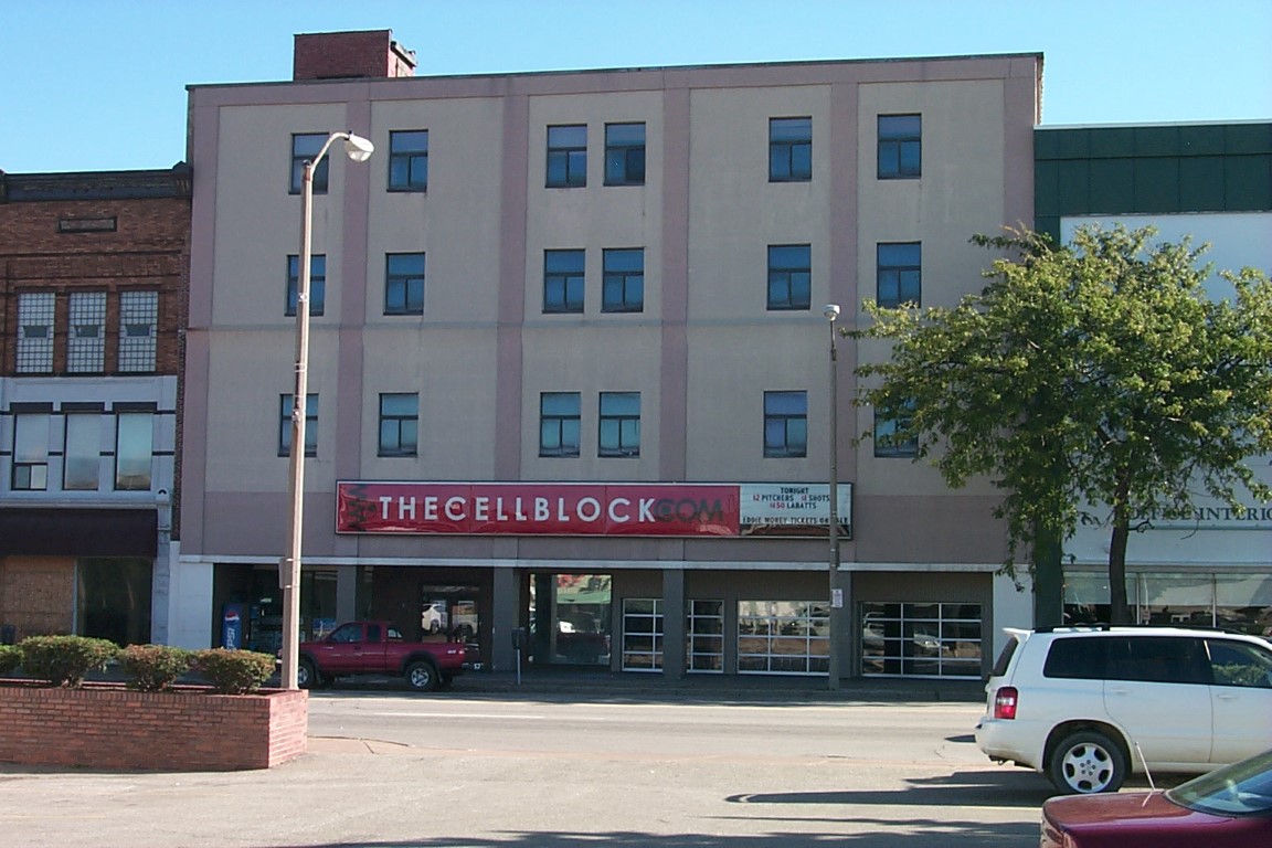
Address: 1213 19 STATE ST
Parcel: 15020003020400
Parcel Profile
Address
1213 | 19 | STATE | ST
Street Status
PAVED | SIDEWALK
School District
CITY OF ERIE SCHOOL
Acreage
0.2663
Classification
C
Land Use Code
RESTAURANTS, STORES (RETAIL)
Legal Description
1213 19 STATE ST 80X145
Square Feet
11600
Topo
LEVEL
Utility
ALL PUBLIC
Zoning
Please contact your municipal zoning officer
Deed Book
2025
Deed Page
019822
2026 Tax Values
Land Value / Taxable
92,800 / 92,800.00
Building Value / Taxable
278,100 / 278,100.00
Total Value / Taxable
370,900 / 370,900.00
Clean & Green
Inactive
Homestead Status
Inactive
Farmstead Status
Inactive
Lerta Amount
0.00
Lerta Expiration Year
2015
Commercial Data
Card 1
DOWNTOWN ROW TYPE
Business Living Area - 11600
Year Built - 1909
Improvement Name - BOURBON BARREL
Value - 861590
Other Buildings & Yards
No OBY Data Found
Sales History
Sale Date
Type
Price
Book / Page
Other Info
11/5/2025
LAND & BUILDING
415000
2025 / 019822
CORRECTIVE DEED
8/17/2021
LAND & BUILDING
415000
2021 / 022003
SPECIAL WARRANTY DEED
8/27/2020
LAND & BUILDING
175000
2020 / 016987
SPECIAL WARRANTY DEED
10/19/2005
LAND & BUILDING
0
1279 / 2075
DEED
1/24/2005
LAND & BUILDING
150000
1206 / 0455
WARRANTY/SURVIVORSHIP DEED
12/24/1986
0
1663 / 0042
Parcel Sketches
Commercial Card 1
A
MAIN
11600 square feet
B
MAIN
11600 square feet
C
MAIN
11600 square feet
D
MAIN
11600 square feet
Parcel Images
Please note:
this tab is for informational purposes only and may not show all delinquencies, see the Taxes tab for more accurate delinquent taxes due.