Elected Officials
Courts
Departments
Initiatives
Open Government
About
Login / Register
Home
/
Property & Tax Records
/
Property Records
/
Property & Tax Search
/
Parcel Profile
/
Print View
Search for Another Parcel
Parcel Profile
Historical Card
Sketches
Photos
Tax Map
Taxes
Print View
Print This Page
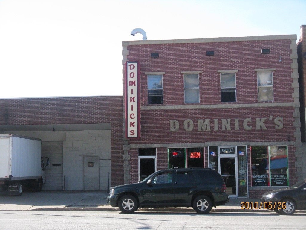
Address: 123 25 E 12 ST
Parcel: 15020008021700
Parcel Profile
Address
123 | 25 | E | 12 | ST
Street Status
PAVED | SIDEWALK
School District
CITY OF ERIE SCHOOL
Acreage
0.0964
Classification
C
Land Use Code
RESTAURANTS, STORES (RETAIL)
Legal Description
123 25 E 12 ST 30X140
Square Feet
8400
Topo
LEVEL
Utility
ALL PUBLIC
Zoning
Please contact your municipal zoning officer
Deed Book
2025
Deed Page
007735
2026 Tax Values
Land Value / Taxable
25,200 / 25,200.00
Building Value / Taxable
149,100 / 149,100.00
Total Value / Taxable
174,300 / 174,300.00
Clean & Green
Inactive
Homestead Status
Inactive
Farmstead Status
Inactive
Lerta Amount
0
Lerta Expiration Year
0
Commercial Data
Card 1
DOWNTOWN ROW TYPE
Business Living Area - 8400
Year Built - 1924
Improvement Name - DOMINICK'S REST.
Value - 139760
Other Buildings & Yards
No OBY Data Found
Sales History
Sale Date
Type
Price
Book / Page
Other Info
5/15/2025
LAND & BUILDING
210000
2025 / 007735
SPECIAL WARRANTY DEED
1/5/2017
LAND & BUILDING
220000
2017 / 000263
SPECIAL WARRANTY DEED
8/31/2001
0
0806 / 0252
5/5/1995
0
0382 / 0718
7/1/1982
0
1462 / 0117
10/5/1976
0
1239 / 0264
7/20/1972
0
1073 / 0673
3/9/1964
0
0892 / 0101
6/11/1959
0
0800 / 0109
10/29/1943
0
0442 / 0471
Parcel Sketches
Commercial Card 1
A
MAIN
4200 square feet
B
MAIN
4200 square feet
Parcel Images
Please note:
this tab is for informational purposes only and may not show all delinquencies, see the Taxes tab for more accurate delinquent taxes due.