Elected Officials
Courts
Departments
Initiatives
Open Government
About
Login / Register
Home
/
Property & Tax Records
/
Property Records
/
Property & Tax Search
/
Parcel Profile
/
Print View
Search for Another Parcel
Parcel Profile
Historical Card
Sketches
Photos
Tax Map
Taxes
Print View
Print This Page
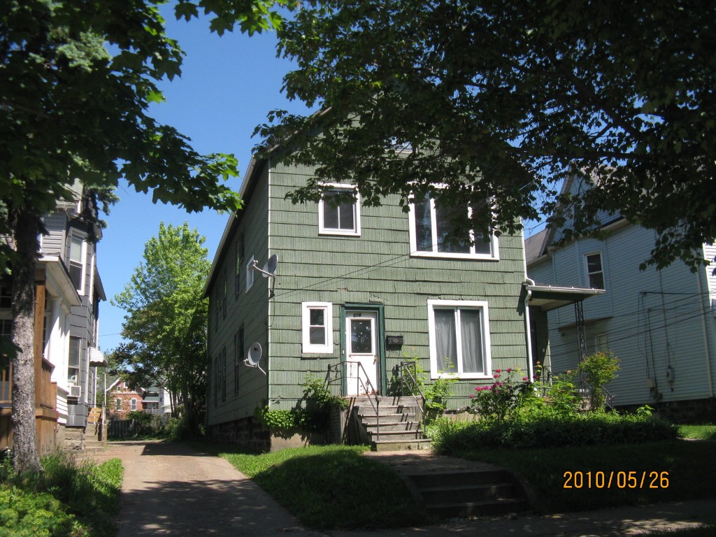
Address: 218 20 E 10 ST
Parcel: 15020011012900
Parcel Profile
Address
218 | 20 | E | 10 | ST
Street Status
PAVED | SIDEWALK
School District
CITY OF ERIE SCHOOL
Acreage
0.1562
Classification
A
Land Use Code
APARTMENTS 4 - 19 UNITS
Legal Description
218 20 E 10 ST 41.25 X 165
Square Feet
6481
Topo
LEVEL
Utility
ALL PUBLIC
Zoning
Please contact your municipal zoning officer
Deed Book
2011
Deed Page
015943
2026 Tax Values
Land Value / Taxable
8,500 / 8,500.00
Building Value / Taxable
41,500 / 41,500.00
Total Value / Taxable
50,000 / 50,000.00
Clean & Green
Inactive
Homestead Status
Inactive
Farmstead Status
Inactive
Lerta Amount
0
Lerta Expiration Year
0
Commercial Data
Card 1
RESIDENTIAL 4 FAMILY
Business Living Area - 5125
Year Built - 1907
Improvement Name - APARTMENTS
Value - 62840
Card 2
RESIDENTIAL 2 FAMILY
Business Living Area - 1356
Year Built - 1907
Improvement Name - APARTMENTS
Value - 17150
Other Buildings & Yards
No OBY Data Found
Sales History
Sale Date
Type
Price
Book / Page
Other Info
7/14/2011
LAND & BUILDING
17000
2011 / 015943
SPECIAL WARRANTY DEED
4/27/2011
LAND & BUILDING
0
2011 / 009369
SHERIFF'S DED
1/7/2002
LAND & BUILDING
0
841 / 1244
11/2/2001
LAND & BUILDING
52900
822 / 1841
4/10/1967
0
0958 / 0356
4/8/1947
0
0493 / 0347
9/27/1946
0
0483 / 0374
1/23/1946
0
0471 / 0013
Parcel Sketches
Commercial Card 1
A
MAIN
1454 square feet
B
MAIN
1490 square feet
C
MAIN
1454 square feet
D
MAIN
727 square feet
Commercial Card 2
A
MAIN
432 square feet
B
MAIN
492 square feet
C
MAIN
432 square feet
Parcel Images
Please note:
this tab is for informational purposes only and may not show all delinquencies, see the Taxes tab for more accurate delinquent taxes due.